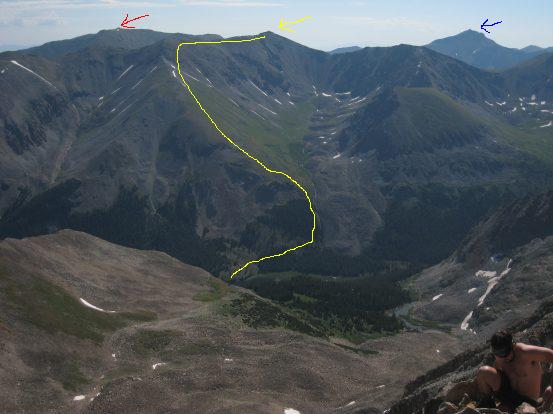
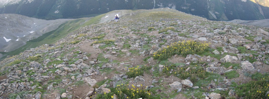
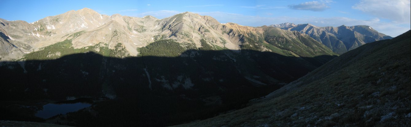
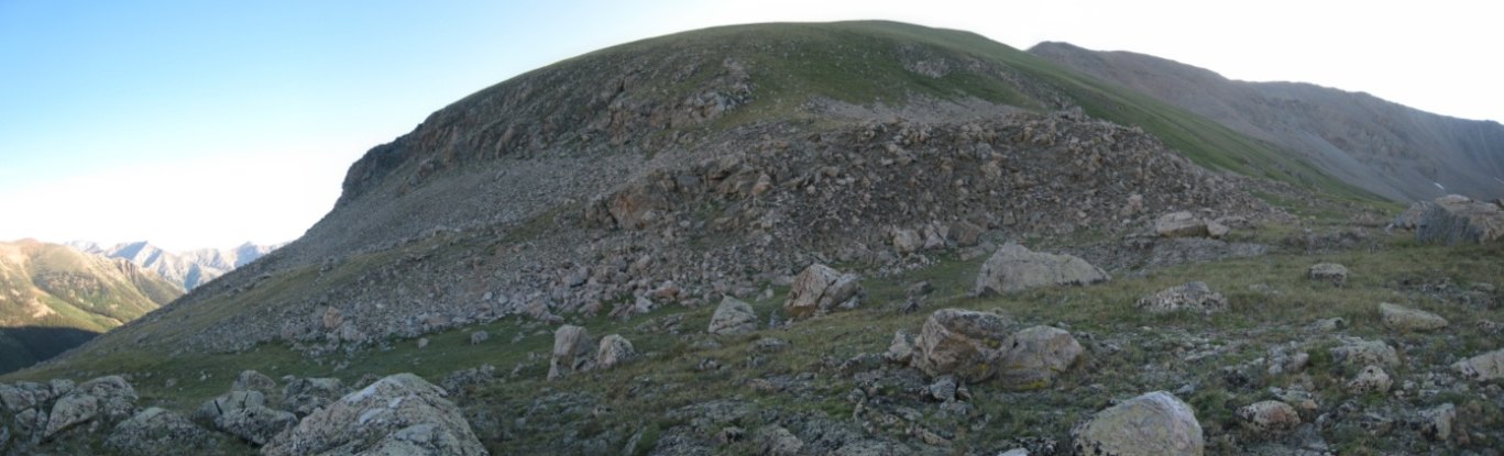
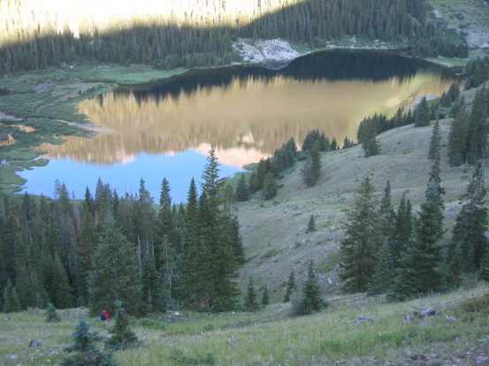
A pic taken from our Huron hike this morning, with an overview of our planned route up Missouri's west ridge (in yellow). The red arrow points to Belford, the blue arrow to Harvard...
Having just hiked Huron this morning, and driven down the 4x4 road past Winfield, it was time to focus on the Rockdale valley, leading to Cloyses Lake where we'd be attempting the west ridge to Missouri tomorrow morning. The 4x4 road leading up from Rockdale would be a whole different ballgame compared to Winfield's 4x4 road. There was a large stream crossing in store, as well as much rockier ground. But everyone says a stock high clearance vehicle will manage fine, so we should be ok in Tom's Jeep.
A pic taken from our Huron hike this morning, with an overview of our planned route up Missouri's west ridge (in yellow). The red arrow points to Belford, the blue arrow to Harvard...
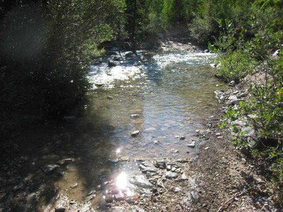
We turned into Rockdale, distinguished by a group of cabins visible from rt 390, and noticed some CO license plates hanging up on a tree at the start of the 4x4 road, which looked like odd decorations at the time. The stream crossing presented itself immediately, and we paused, along with people from another vehicle, to check out the stream. It wasn't too deep at this time of year, but it was quite wide. We had read lots about this stream crossing online, so we were prepared to keep to the left side, and didn't anticipate much trouble.
VIDEO of crossings: Click on each pic below for a video of the two crossings
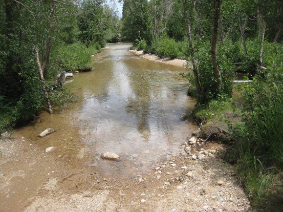
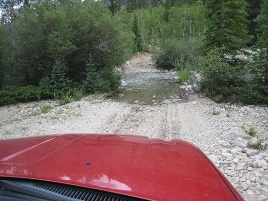
The stream crossing consisted of two portions. The first was long but shallow, the second was shorter but deeper, and involved a climb immediately after the crossing. Turns out the recommendation is to stay left of the island in the first crossing, but we didn't realize what island that meant, and passed it on the right (according to the video). The 2nd crossing was a bit bumpy at the finish, as we basically floored it straight across, so it's best to stay left and come up at an angle...
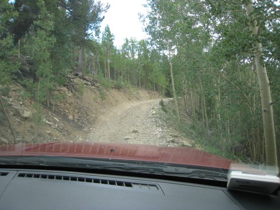
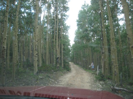
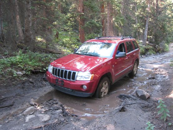
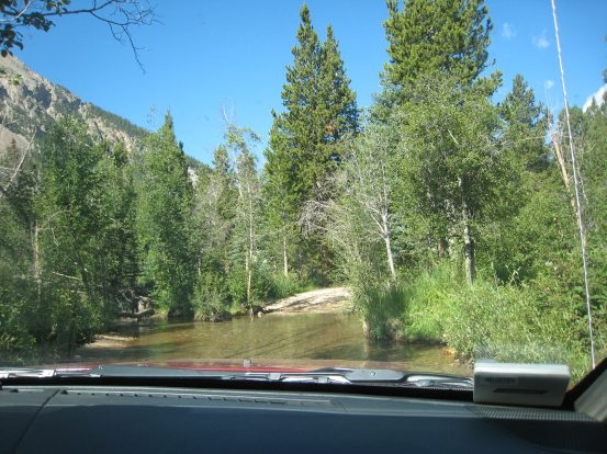
After the rough but successful stream crossing, we drove up the valley along a rocky, rutty road. The going was slow, and we scraped the skid plates a couple of times. The pics here show some of the smoother areas. Once a large mud puddle hid a hole that caused us to hit the skid plates. It's best to avoid the puddles as much as possible. This is definitely a high clearance road...
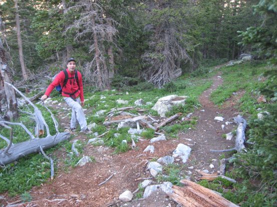
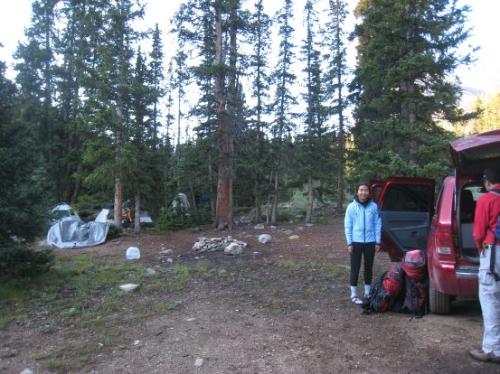
It took us just over 30 minutes to drive the ~2.5 miles to where we found several camp sites in an open area at what appeared to be the end of the road. There had been a few sprinkles during our drive up, and the sky was still filled with clouds as we set up our tents. The camp spot was large and had a nice fire ring. Tom noticed that his front license plate was missing, and we wondered at which bump in the road it may have come off (or if it came off on the Winfield road). Now the license plates hanging on the tree at the bottom made a lot more sense. We'd have to look for it on the way back, and hope it didn't get washed down the stream...
Once our tents were up, we decided to go check out Lake Cloyses, but as we started walking, the rain increased, and we heard some thunder. So we went to plan B, which was huddling inside a tent to play a card game. Good thing we got the tents up just in time before the rain!
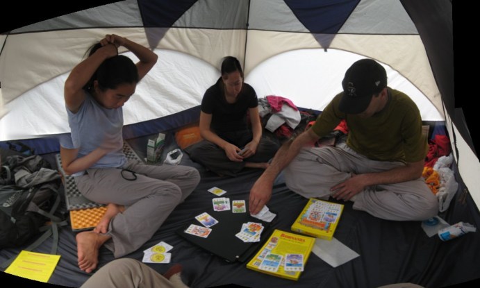
Christine's big 4-man tent came in very useful, as we all fit pretty comfortably inside while we played Bohnanza, one of our favorite games. By the time Christine won, an hour or so later, the rain had stopped. This 5 pic merged shot sure came out funny looking...
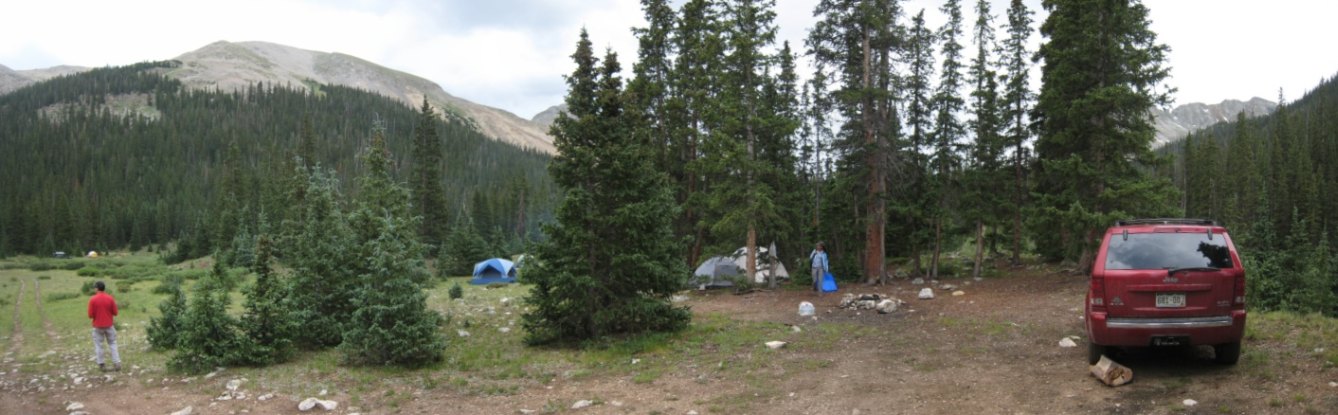
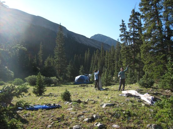
A look at our camp site after the rain had passed by. It looked like the clouds would be hanging around for quite a while...
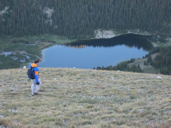
It was .5 miles to Lake Cloyses, and we set out to visit it. Turns out the road continues almost all the way to the lake, but we left the car at camp and walked. After a short ways, Wendy and Christine turned back, as they decided they had already had their fill of hiking this morning, and a lake under cloudy skies didn't seem worth the effort at this time. They could always check out the lake tomorrow morning while Tom and I hiked Missouri.
So Tom and I took off for the lake, and found several more cars parked at the end of the road, which stopped ~150 yards short of the lake. There was a decrepid non-functional latrine off to the north of the lake, and ashes from (according to some people there) a recently burned down cabin / fish hatchery. Apparently this cabin had a wonderful porch to sit and admire the lake. The structure was totally burned out from the bottom up, with the metal gutters lining the debris around the edges. It was a sad sight.
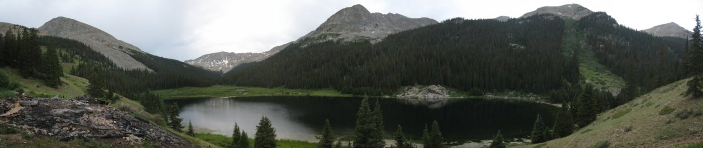
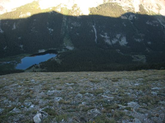
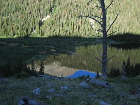
Lake Cloyses. The burned debris of a fish hatchery is on the left. The constant circles appearing on the surface of the lake gave away it's healthy fish population...
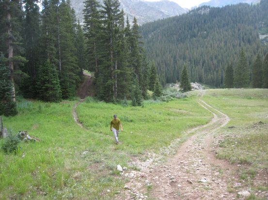
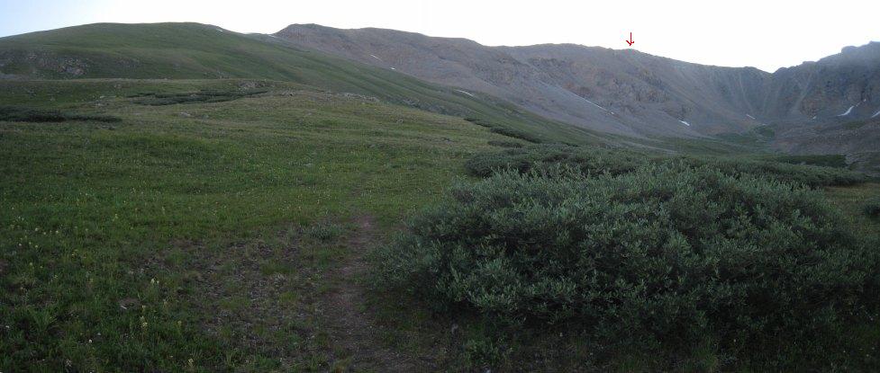
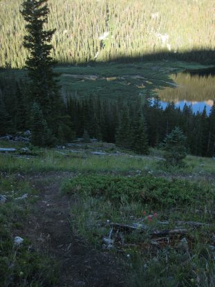
Tom and I planned to start hiking in the dark tomorrow morning, and wanted to explore the trails leading to Missouri in the light this afternoon, so we went back to the road and found the climbers trail branching off to the left, just before the lake comes into view. We followed the trail a good .3 miles and noted all the potential wrong turnoffs along the way. We hiked up over the east side of the lake, which gave us great views of Huron and Cloyses Lake. After satisfied that it was obvious the trail continued on towards the stream, where it would take a left and start climbing up towards Missouri, we turned around and headed back to camp. When we returned, we found Christine sleeping in the car, and Wendy watching a DVD in the back seat.
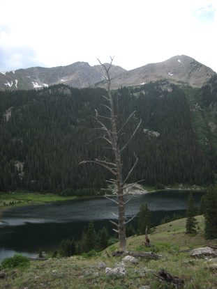
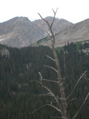
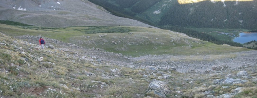
Tom and I explored the trail past the lake to be sure we knew the correct path to take tomorrow morning for our Missouri hike. Huron, which we hiked earlier in the day, is the peak nestled in the "Y" branches at the top of the tree in the two pics. Here's a look back near our turn around point...
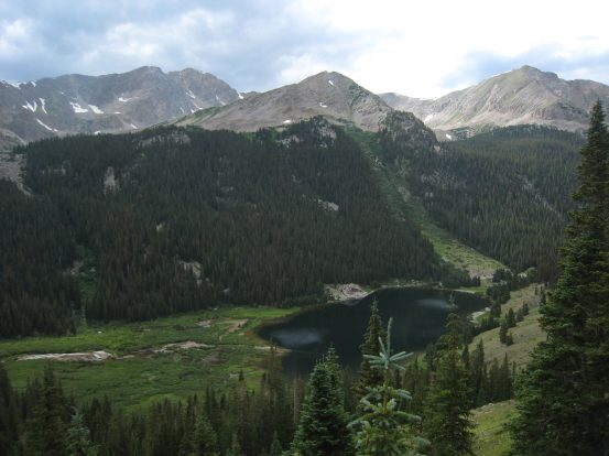
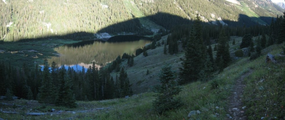
Tom is looking at a path cutting straight up the hill here (not pictured), which later rejoins the main trail. I had read about this alternate trail. Seemed to make a lot more sense to keep to the main trail, which we planned to do tomorrow. Notice the avalanche zone at the right edge of the lake...
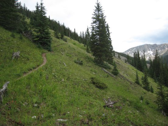
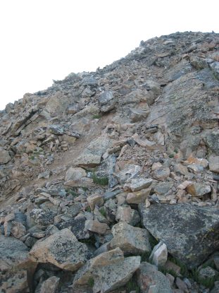
On the way back I took some pics of the trail, for reference of where you want to be. Lots of trip reports mention that they miss the turn off leading up to Missouri. In the right pic, it would be very easy to continue straight past a thin row of rocks towards the lake, but the trail actually goes towards Tom. This was the biggest potential for a mis-turn in the dark...
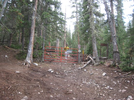
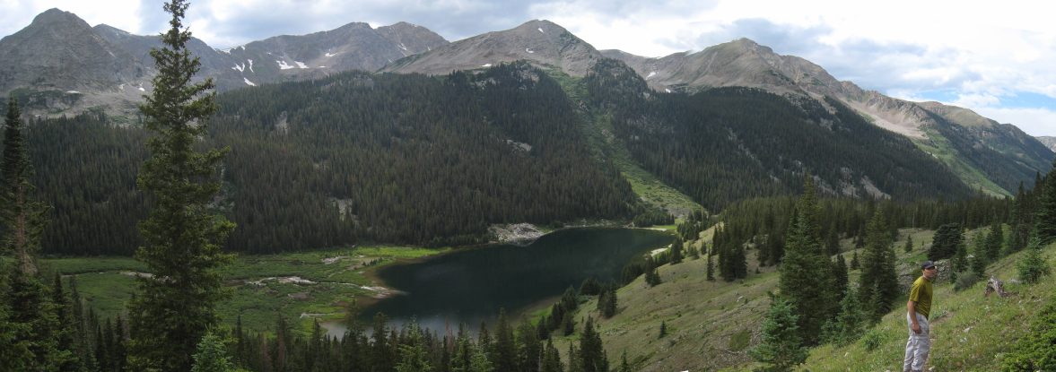
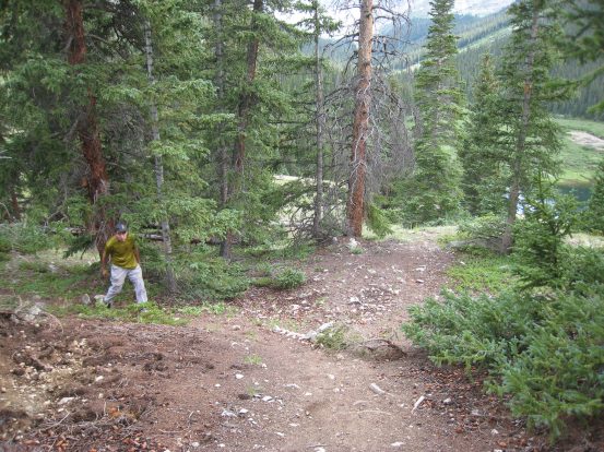
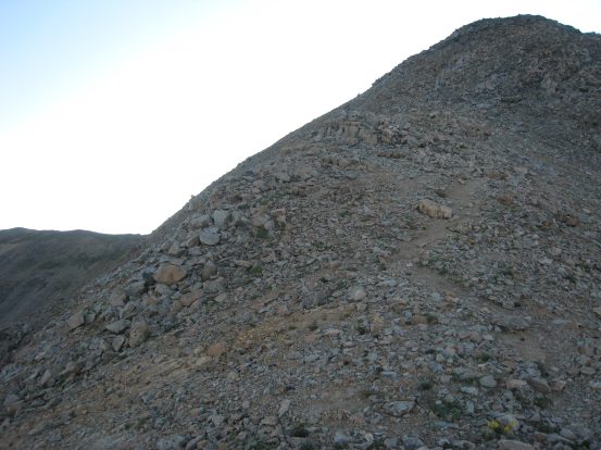
Here is Tom walking back to main trail from the climbers trail. The lake is just over the lip on the right. The climbers trail splits to the left. I also included a pic of the gate at the end of the 4x4 road. It's just ~150 yards from here til the lake...
It was time for an early dinner, so we started the fire, and began cooking feast #2. We weren't as hungry as last night, but as the food started cooking, we ended up eating and cooking and eating more. Like last night, we had sausages and veggies on the grill, including some zuchini from Tom's garden, as well as some hot dogs this time. Tom also made some rice with carrots and shrimp on his stove that was tasty. For dessert we had the last of our stale marshmellows, and a freeze dried ice cream sandwich that Tom shared.
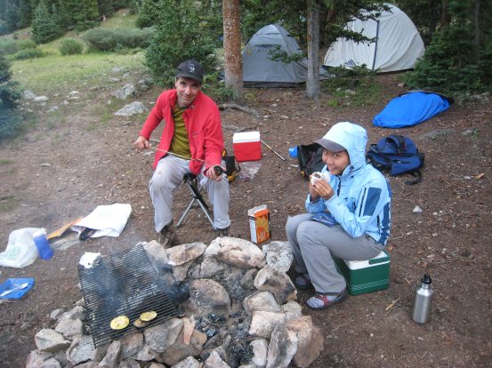
A few remaining zuchini slices sit on the side of the grate after dinner, as Tom handles a "very well done" marshmellow. Wendy nibbles on a piece of freeze dried ice cream sandwich that Tom brought and shared....
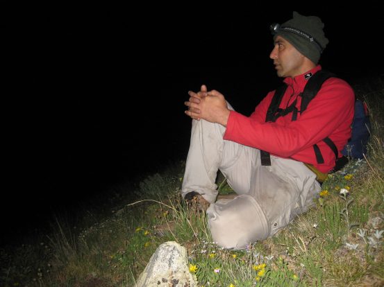
We were finished with dinner ~7pm, and there wasn't much left to do but hit the hay. Tom and I were planning to get up at 3:15am tomorrow for our hike up Missouri. Wendy and Christine would start breaking down camp prior to our return, and we planned to be driving out by 10am. We prepped our gear for the next day, and before I went to bed, Tom said that if I couldn't sleep in the night, to wake him up, and we'd start even earlier. I went to bed ~8pm, and heard Wendy and Christine playing a game of Bonanza in the nearby tent. The thought of catching sunrise on a 14er was enough to ensure that I'd be awake before 3:15am, and I even set my alarm for 2:40am, just in case. Turns out I wouldn't need it.
I woke up at 11:58pm, pleased that I got ~3 hrs of sleep already. I figured the chances of me falling back to sleep where slim, and indeed, I just lay there until 2:25am, when I decided it was time to wake up Tom and get a jump on our hike. We didn't bother cooking a breakfast, not after that huge meal last night, and started hiking at 2:55am with our headlamps. The hike to Missouri would be 6 miles r/t with 3300' of gain, which is the shortest route up to Missouri. Most people hike it from the other side of the mountain, as the trailhead is much more accessible.
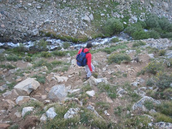
We were confident of our path, even in the dark, thanks to our scouting yesterday. It took us 11 minutes to reach the turn off to the climbers trail. And sure enough, we almost missed the trail at the spot I mentioned in a previous pic, but continued on our way up above the east side of the lake. I noticed the "alternate trail" cutting up the hillside, but we continued on the main trail, and eventually reached the stream, where we followed a steep rocky trail along side the falling water.
The stretch along the stream didn't last very long before the trail broke off to the left at the beginning of a long steep grassy slope. The next mile would cover ~2500' of gain. We followed the dirt trail for quite a ways until it dissolved, and then we were left to choose our own adventure by means of our headlamps. We knew we had to stay on the grass, and I had a pic on my camera taken from the top of Huron yesterday of this entire side of the mountain to refer to. We got a little confused when we reached a small section of boulders/rocks, but ended up just climbing up it, and finding indications of other footsteps to help us feel confident of our path. Then we just kept climbing up and up. I stopped now and then to try to capture a pic, but with no moon out it was REALLY dark. With my camera in my pocket most of the time, I was making good time up the mountain.
A glimpse of the stream next to the trail at 3:30am, before reaching the grassy slope. A long exposure shot of Tom climbing up the grassy field at 4am.
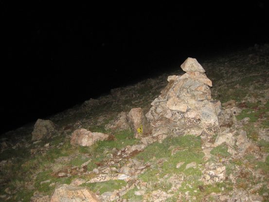
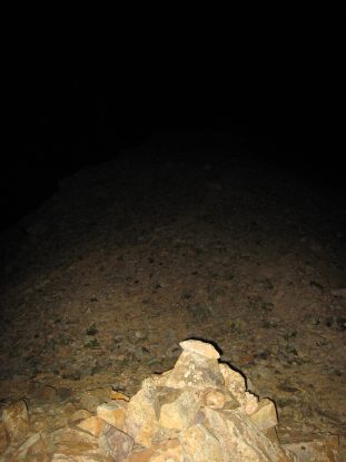
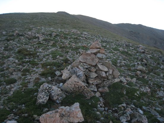
I realized a flash was necessary to get a reasonable pic, despite my efforts at long exposures. Tom takes a break on the way up, ~4:10am. This field was described as having lots of flowers. We'd get a better look on our way back down later. After another 20 minutes, we found a cairn, and felt good about our position...
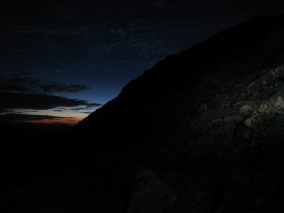
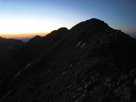
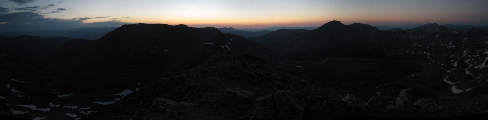
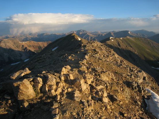
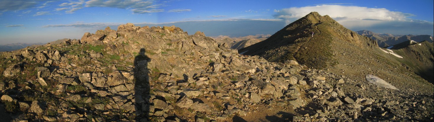
We kept climbing and found additional largely separated cairns. We noticed the sides of the hill where rounding off on both sides, and realized we had reached the start of the ridge, at 13,200'. The rest of the way would be more rocky than grassy. Straight ahead we could see a large mound, which marked the top of the ridge at 13,950'. We followed a path up the left side of the steep rocky arm (still just class 2 the whole way), and caught our first glimpses of the horizen to the east. We topped out on the ridge at 5:15am to a gorgeous view of the pre-dawn sky. Sunrise wasn't until 6:07am, so we were making great time.
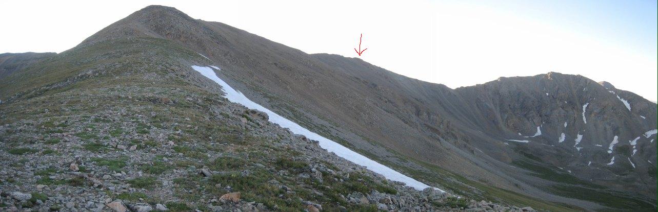
When we reached this cairn, we noticed the sides of the hill were rounded, and knew we had reach the start of the ridge. Further up we caught our first glimpse of the horizen. Remember to stay to the left when climbing the final stretch to the top of the ridge. The trail is well built here...
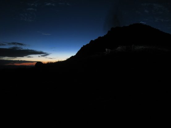
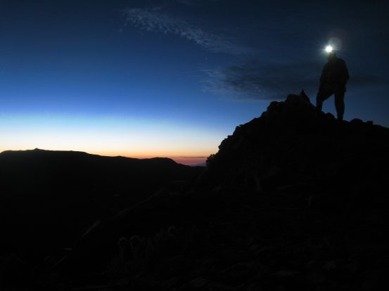
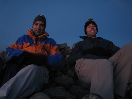
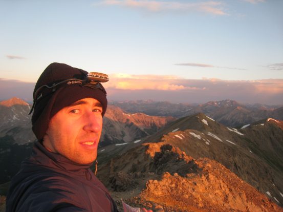
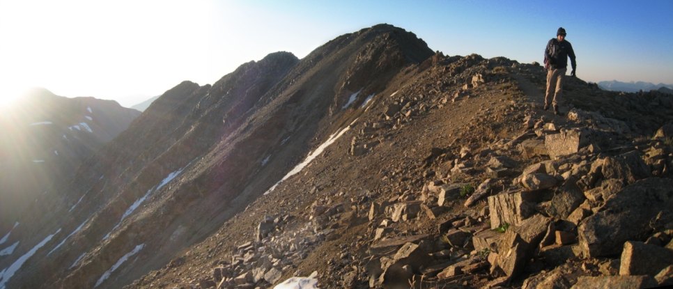
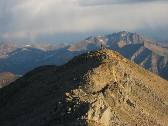
Minutes away from the top of the 13,950' ridge, I took this pic on the left. Notice the thin white streak at the top of the mountain? That's Tom's headlamp as he walks along the ridge. When I caught up, I got him to pose on the ridge next to the pre-dawn horizen...
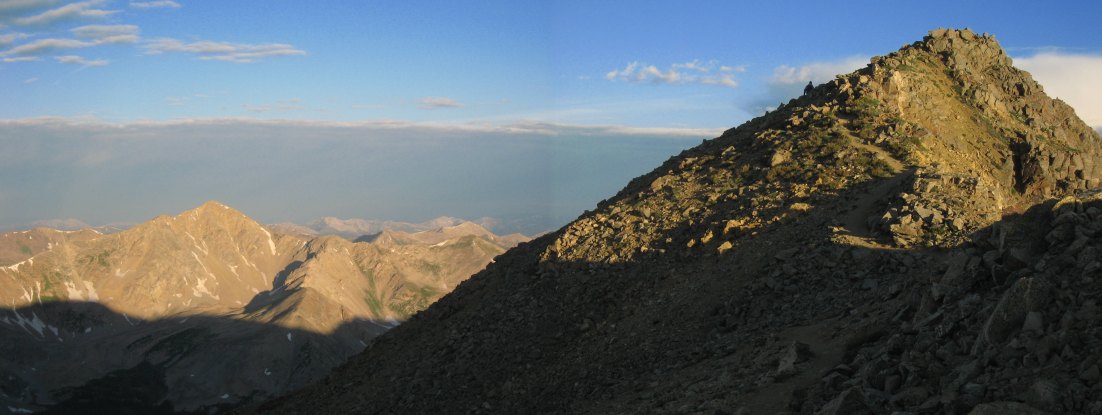
I stayed around at this spot and played with my camera. Here's a timer shot with some different settings, and me standing up on the right. Belford is the small point on the far ridge. It was pretty magical up here on the ridge at this hour...
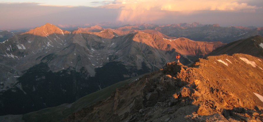
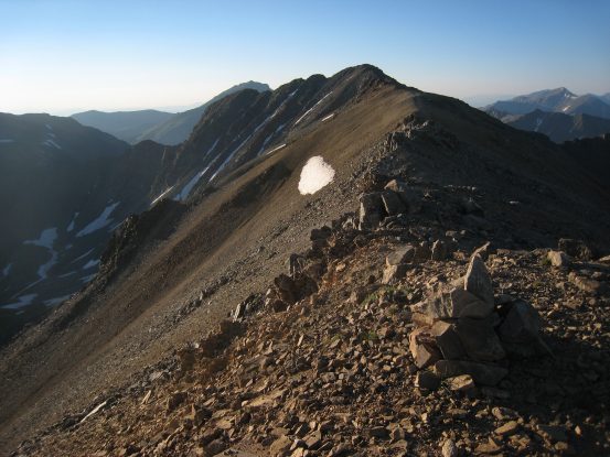
I took my time along the ridge. It was ~.8 miles to reach Missouri, but only 100' of gain. Missouri is the peak on the right above the snow...
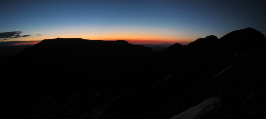
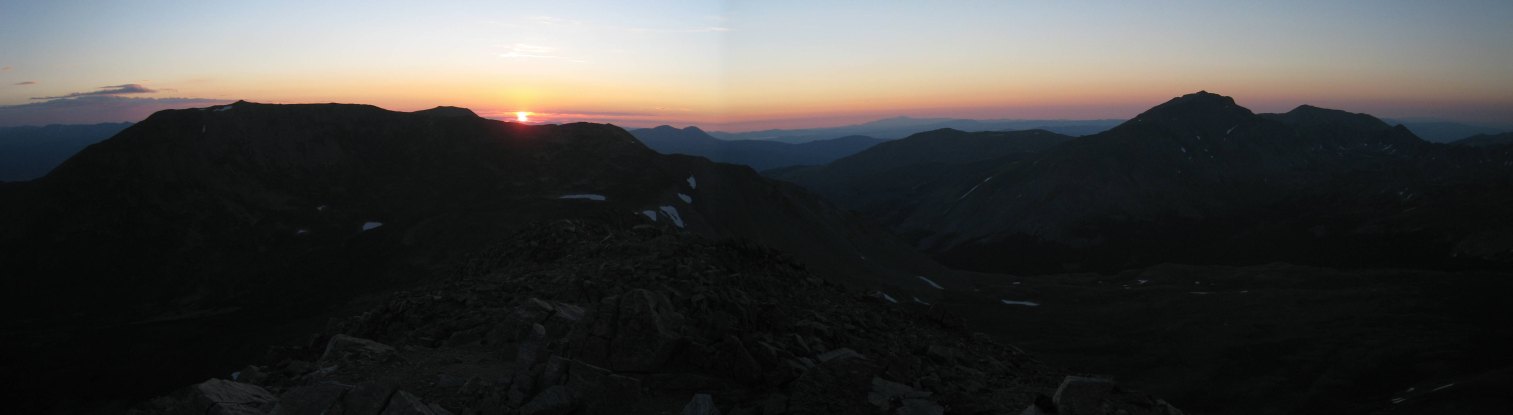
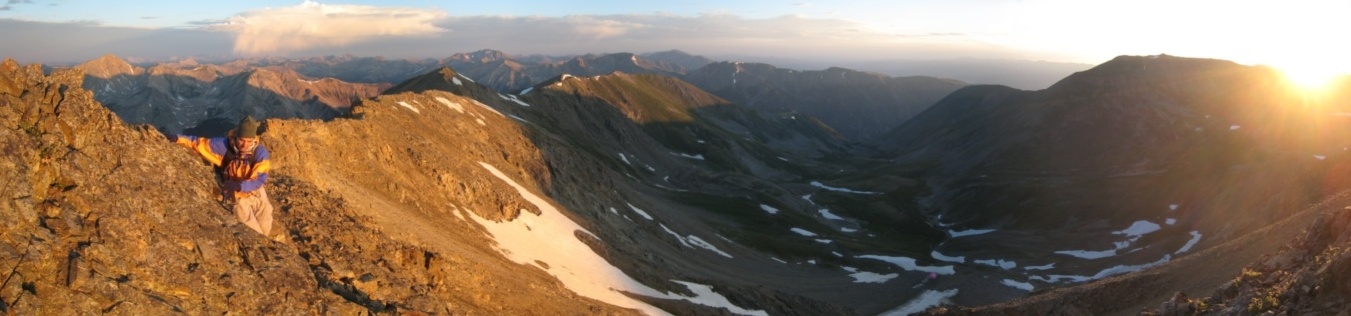
Another stitched shot a few mintues later on the trail with some different camera settings. The deepest reds seem to emerge ~45 minutes before sunrise. Good thing we started extra early today...
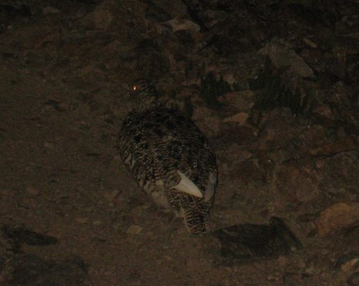
The trail stayed up along the ridge, skirting along the left or right occasionally. The trail itself was pretty, but at this hour the horizen held our gaze. Tom waited up for me and told me there was wildlife ahead. I approached slowly with my camera ready, and saw three ptarmigans at 14,000' on the trail. Got a decent pic at 5:35am...
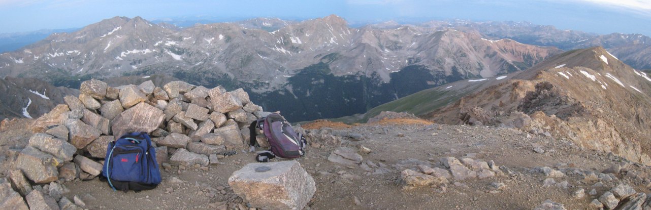
Missouri's peak was approaching quickly, with one sharp section to go. The trail side skirted the ridge off and down to the right, which we took, though it was tempting to keep the ridge, and try some class 3/4 moves. But we were focused on reaching the summit for sunrise, and took the fastest approach. By 5:45am, we had both reached the peak, almost 25 minutes ahead of sunrise. I put on my extra layers, and waited comfortably at the top, watching the day break. I always considered food on top of a 14er to be my lunch, but a 5:50am lunch seemed wrong...
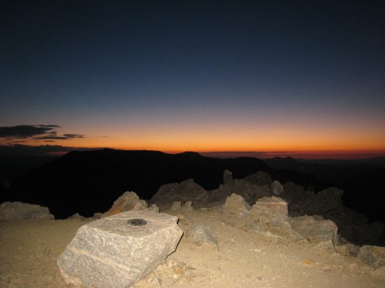
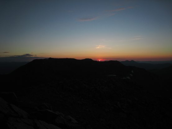
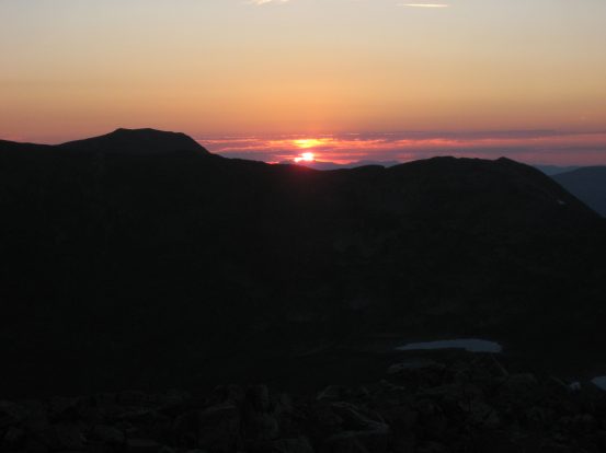
The view at 5:45am atop Missouri. We made it up a 14er for sunrise, the first time for both of us...
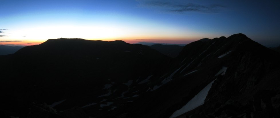
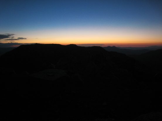
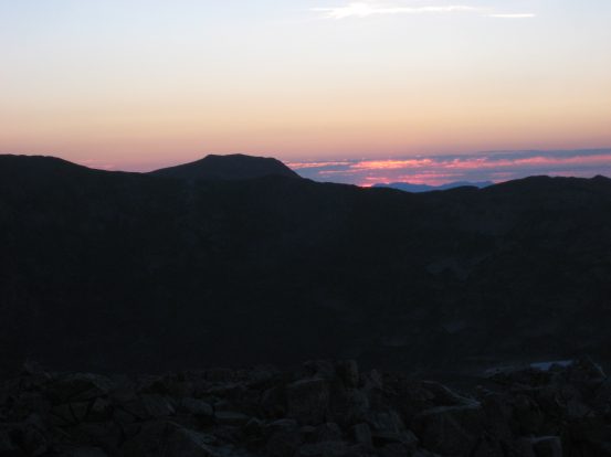
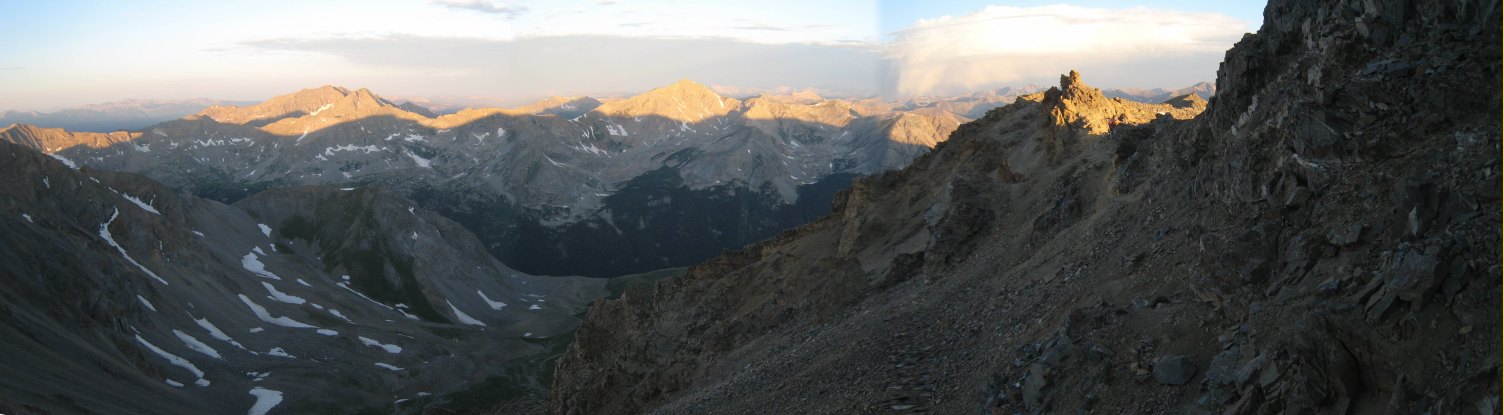
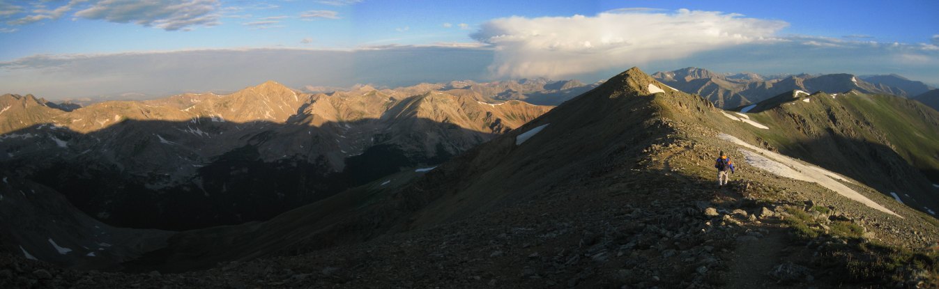
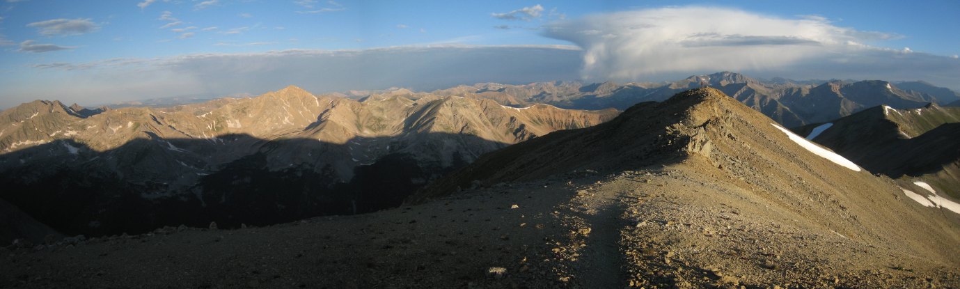
A wide view to the east. It looked like the sun would emerge south of the cloud mass on the left. Belford is on the left, Harvard is on the right...
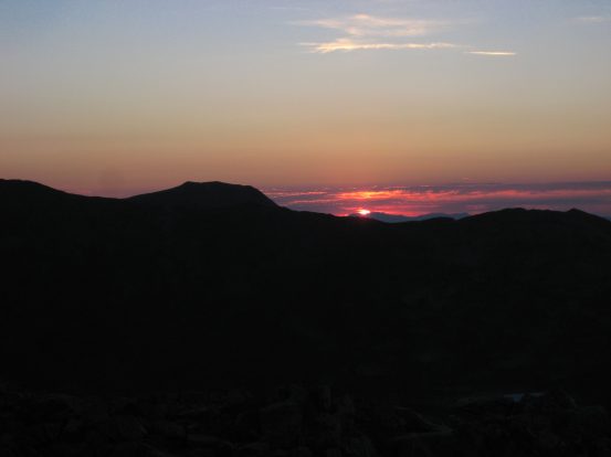
We relaxed on the rocks at the top. There was very little wind. Temps were cool, but it was very pleasant for 14,000' at 6am. We watched as the red horizen turned pink...
It was getting light out, but we were still waiting for the sunlight, and hoping for some great alpenglow...
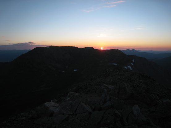
Finally at 6:07am the sun broke over the horizen, and quickly emerged...
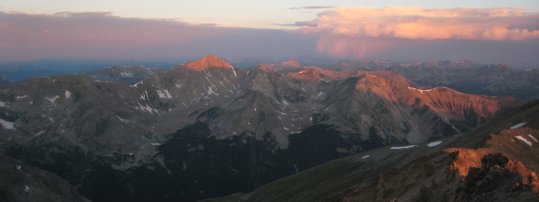
A wider view of the sunrise scene, with Harvard on the right...
Some close-ups of sunrise. The sun rose just to the right of Oxford...
Unfortunately, my camera gave me the "low battery" warning, and I couldn't find where I placed my back-up (found it later), so I didn't take too many pics at this moment, but still got a few good ones. Here's the alpenglow to the west. Huron, which we climbed yesterday, is the tall peak in the center left...

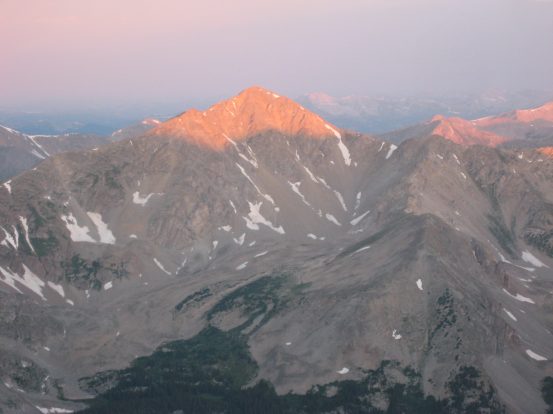
The golden sun is shining bright this morning. Here's a close-up of Huron. We hiked Huron from the other side...
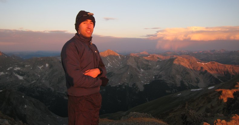
A couple of pics of me in the alpenglow, shortly before we departed Missouri. Huron appears in the background...
We started the descent ~6:20am. I love this pic of Tom standing on the golden ridge, with Huron on the left. There was a bizarre cloud in the distance that almost looked like rain. Glad we weren't in that vicinity. Looked like it was over the Elk Mountains...
On the way back, we decided to try to stay atop the ridge more, but found ourselves looking at a nasty downclimb, so we backtracked and skirted the ridge again...
We dropped below the ridge, to the west...
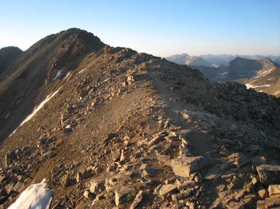
A couple of pics here of the trail atop the ridge, in each direction. The 2nd pic is looking back at Missouri...
This part of the trail reminded me of the White Mountains, NH, trail on the Franconian Ridge to Lafayette (but 9,000' higher)...
Soon the end of the ridge was in view, and we could see the grassy slope extending down to the left. That big drooping cloud ahead still had us wondering if it was dropping rain. Just glad it wasn't near us...
I considered putting on sunscreen, but in a few minutes we'd be hiking down the west side of this mountain, entirely in the shade. Pretty rare to not need sunscreen on a 14er hike...
Tom rounds the last mound on the ridge before we reach the arm leading back down...
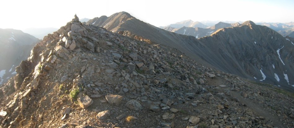
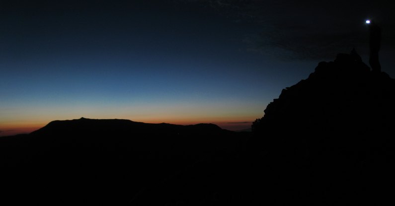
Here's the spot where I captured those pics of us standing with our headlamps on, next to the horizen. Missouri is the large bump further on the ridge...
Tom was already standing at the end of the ridge, ready to enter the shadowy descent...
A close-up of Tom at the end of the ridge, at 13,950'. Here's the view from that point looking back towards Missouri. Missouri is the highest bump on this ridge...
Another look at Huron as we head back. Just below the 13,950' ridge top is the trail junction for the standard route coming up the east side of Missouri...
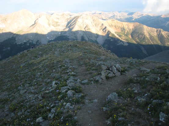
Remember to aim towards the right side where the trail picks up for the rocky descent. From the top a loose trail led to the left, and I ended up cutting back over across the rocks to the right. Pretty flowers up here...
Some looks at the rocky descent. The trail is on the north side of the arm...
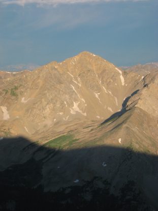
A look from further down the arm. Missouri is marked with the arrow...
This cairn was one of the few familiar sites from the dark climb this morning. This grassy slope was supposed be to known for its wild flowers, but it didn't compare to the beauty of Huron's basin and slope yesterday...
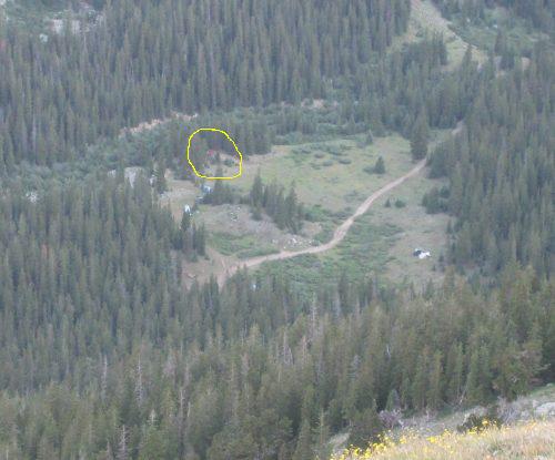
We could see Cloyses Lake and the meadow where we camped. We could even see Tom's red Jeep next to our camp site (circled). The lake looked a lot closer to camp than the walk to get there felt...
A wide view of the valley. We'd definitely be staying in the shade the rest of the way back...
We angled to the left, knowing we needed to reach the stream coming down the mountain, past the willows...
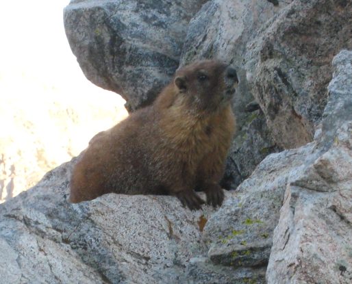
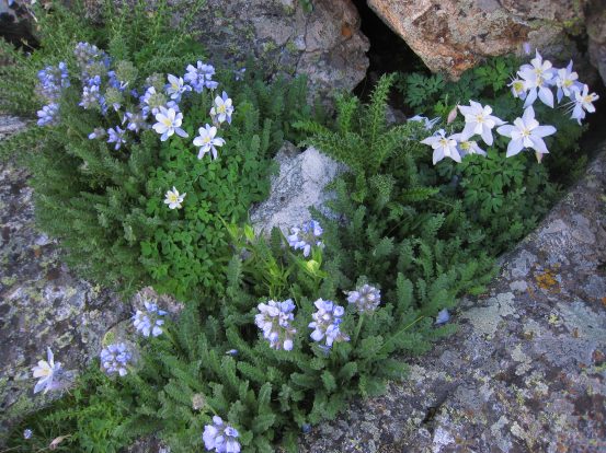
We reached the group of boulders from this morning, and I spotted a slack-jawed marmot. He looked a bit goofy checking me out. There was a small patch of columbines nearby too...
Here's a look back at the group of boulders that confused us this morning. There were decent paths going up/down the boulder field, so no need to bypass it...
We cut across the grass to the willows, and picked up the dirt trail. Here's the point, looking back, where the trail fades out. The arrow points to Missouri...
We followed the trail to the stream, and descended along it. Very soon we saw the junction with the "alternate" trail. Tom thought it would be a good idea to check it out, and give a recommendation on the trip report. No doubt the stream would be more scenic (we missed the scenery in the dark this morning), but it sounded like a good idea to explore the alternate path...
The "alternate" path should be called Fallen Tree Trail, based on the number of times we had to hurdle logs. The trail was largely well maintained, though there was a confusingly steep part. I'd definitely recommend the standard trail along the stream. Here's a view of the lake, with Tom in red back on the main trail in the lower left. The 2nd pic shows the "alternate" trail merging with the main trail...
A view of Cloyses Lake from the main trail. A nice reflection on the lake...
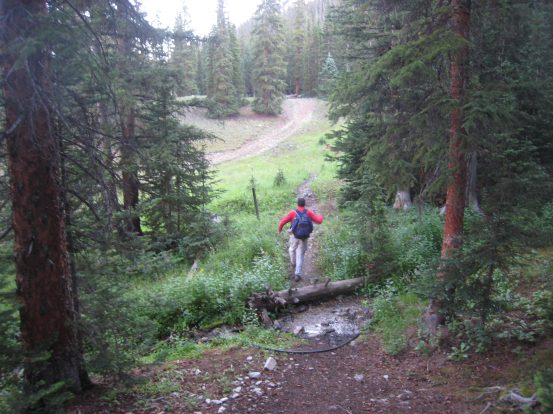
Another look at the reflection on the lake. We hustled the last stretch back, being very familiar with this area after yesterdays scouting expedition. Tom jumps over the stream as we return back to the road...
We got back to camp at 8:10am, where we saw Wendy and Christine breaking down the tents and hanging up tarps to dry. Tom and I joined in, and by 8:45am we were packed up and starting the drive back down the 4x4 road...
I got out at a couple mud puddles to measure the depth of the water, trying to avoid any big holes. We took the drive nice and slow, and had no trouble reaching the stream crossing. Here's a look at the 1st stream crossing coming back...
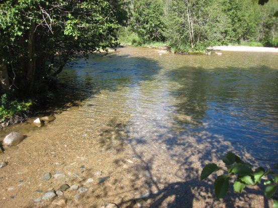
We didn't see Tom's license plate along the creek, and readied for the 2nd stream crossing. The road curves to the left, through the water. Once on the other side, Tom's license plate wasn't hanging up on the tree, so it must have been eaten by the road somewhere. It took us 50 minutes to reach rt 390. 20 minutes longer than our ascent up the 4x4 road, but this drive was smoother...
It was 9:35am, and we had reached the main roads. The weather was great again this morning for the drive back. Along the way, there was talk of stopping to eat, and I felt I could be ready for supper, and then realized it was still just 11am. The early start had my internal clock messed up for the rest of the day.
After a stop at McD's in Evergreen, we arrived back in Fort Collins in the early afternoon. None of the bad traffic on I-70 that we experienced last Sunday was around today. We thanked Tom for driving, and were all greatful for his Jeep allowing us to access our two camping locations with ease.
Huron and Missouri put my 14er count at 14, and 8 for the year.