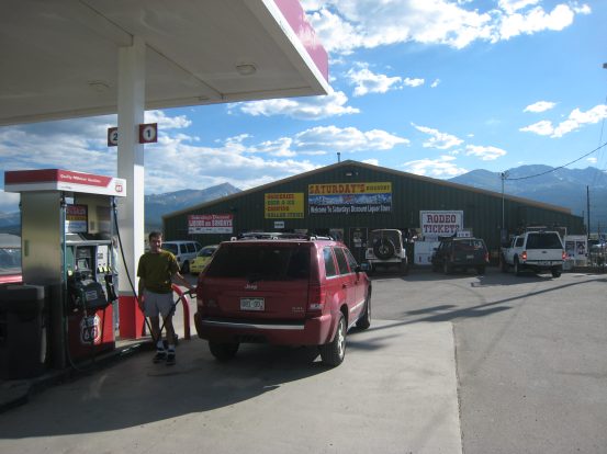
The best gas stop in the mountains. This store has anything you could possibly need, should you forget something, and at cheap prices. Mt Elbert peaks on the left, and Mt Massive on the right...
The drive down was slow going, even at mid-afternoon on a Friday. It took us 2.5hrs to reach the Eisenhower Tunnel from Fort Collins. Our big cushion of day light was being squeezed. We needed to find a camp spot and cook dinner over a fire before dark. We monitored the maroon/brown pine beetle destruction throughout the drive. Eventually we passed Leadville, filled up on gas at our favorite mountain gas station, and reached the Clear Creek Valley (rt. 390) ~6:30pm, over an hour longer than the drive with Chris to Belford/Oxford two months ago.
The best gas stop in the mountains. This store has anything you could possibly need, should you forget something, and at cheap prices. Mt Elbert peaks on the left, and Mt Massive on the right...
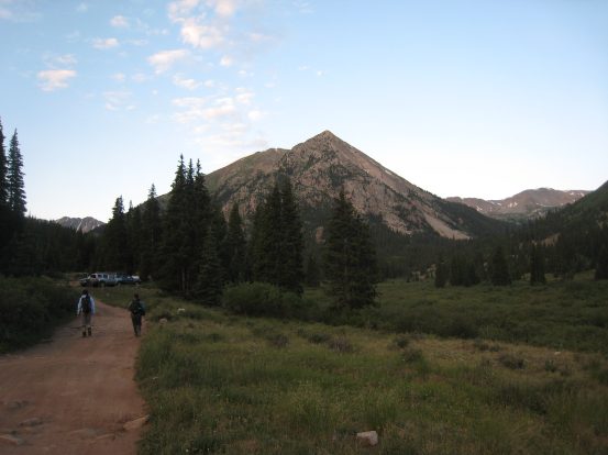
Immediately as the drive up the dirt road began, we all marveled at the lush greenery, bulging mountains, and blue resevior. We followed the aspen lined road deep into the valley, passing the Missouri Gultch Trailhead (from the Belford/Oxford hike), and saw what looked like a camper's festival in the woods, complete with 4 port-o-potties. It was some big CMC (Colorado Mountain Club) gathering. We continued on, making note of the Rockdale 4x4 road turn off, which we would take tomorrow, and finally reached Winfield, a ghost town, at the end of the valley. It was time to figure out where to camp. Winfield had a field of campgrounds, with a latrine, but the ~7 decent spots were filled, so we decided to drive on up the 4x4 road, until we found a good camp spot.
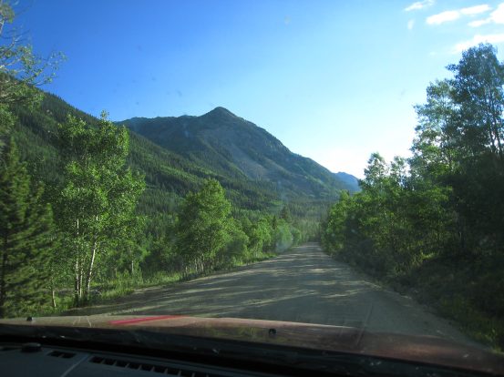
The low sun was lighting up the aspen trees along the road. They seemed to glow green...
The 4x4 road had a parking spot for passenger cars right before it got difficult. Some hikers we passed said there was plenty of camping available in the field near the end of the 4x4 road. Tom's Jeep handled the ~2 mile road fairly effortlessly as we crossed a few 2 inch deep streams, and manuevered around/over some rocks. High clearance is required in a few spots, and I'm thankful for Tom and his Jeep, cause I wouldn't have attempted this in Wendy's CRV.
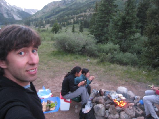
We found a beautiful camp spot about .3 miles from the end of the road, out in an open field with a nearby stream. The views to the north and south were excellent. All the campsites here have fire rings, which is great, cause we needed one. It was 7:25pm when we started setting up camp. We split up tasks of erecting the tents and prepping the fire pit, and very quickly our camp was feeling homey.
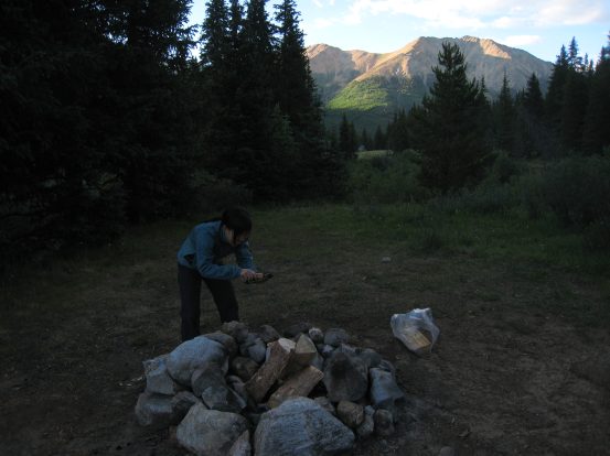
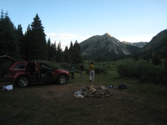
The sun lights up the mountains to the north, as Christine strikes a match. The opens views to the south were scenic too, as Christine, Wendy, and Tom scout out tent spots...
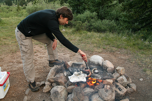
Christine took these pictures of me working the grill. We propped up the grate from my BBQ on some rocks over the fire. I brought a few O'Dells beers (my favorite, and brewed in hometown Fort Collins) to partake in during our feast...
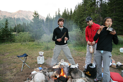
Tom readies his lantern as the Italian sausages start cooking. We featured sausages, zuchini/squash, peppers, mushrooms, and garlic cloves on the grill. Tom's soggy sandwiches from the cooler make an appearance here, in an effort to dry them out for tomorrow...
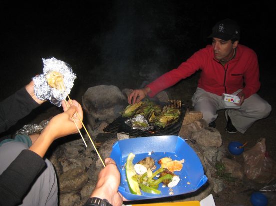
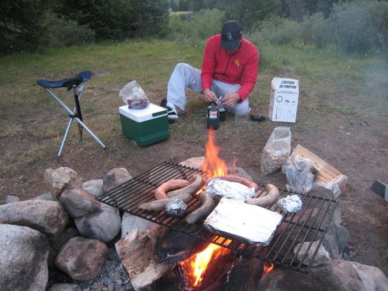
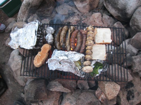
It was a great feast, and we couldn't even find room (on the grill or in our stomachs) for the eggplant, yams, and onions we also brought. Maybe for tomorrow's dinner... We did cook up some corn, as seen on the grill in the right pic. Wendy holds up a BBQ'ed garlic clove in the foil...
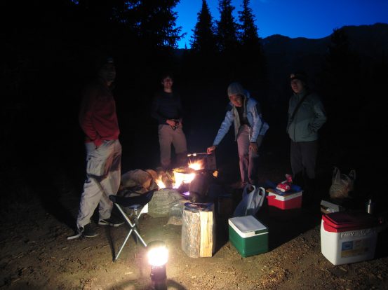
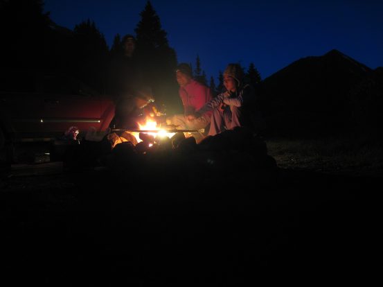
After dinner we brought out the smores supplies. The marshmellows were old and stale, but serviceable. I setup my tripod for these night time shots of us around the fire...
The temperature dropped quite a bit as the evening grew, and we put on an extra layer or two. We decided on a 5am wake-up call for tomorrow's Huron hike, hoping to be ready to go at 6am after some cooked oatmeal for breakfast. It wasn't until ~9:30pm that we finished with the food and fire, and prepped for bed. We went to bed with a chill in the air that we hadn't felt since early spring. The soft sounds of running water in the nearby creek was peaceful. The moonless sky was bursting with stars, and I saw a couple of shooting stars before turning in for the night.
I wondered how much sleep I'd get as I went to bed that night. I layed around and eventually dozed for 2-3 hours before waking up a little before 2am. After lying around for half an hour, I decided to head outside and admire the stars. The milky way had shifted to the west since a few hours ago, and given the new moon, the stars were out in force. After a good 20 minutes, I went back into my tent and rested, but couldn't sleep.
Eventually I heard movement outside from Tom ~4am, followed by the sound of a car alarm bursting loudly into still night air. I figured this was not Tom's intended wake-up call, and in fact his intention was to open his car door without having the headlights turn on. We heard him tell us it was time to get up, but it was only 4:10am, and apparently his iphone had switched over to the Central time zone. Soon enough 5am arrived, and we began the day.
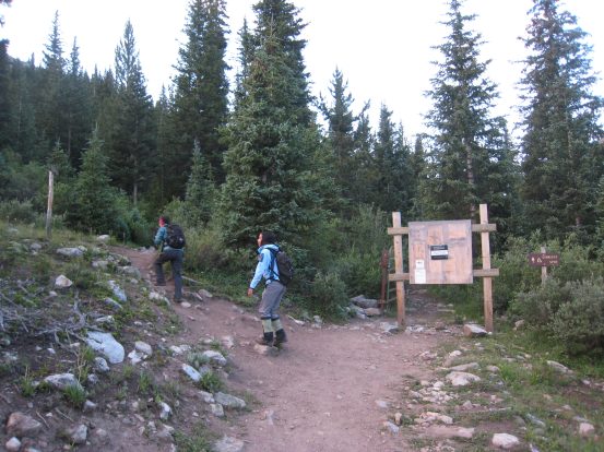
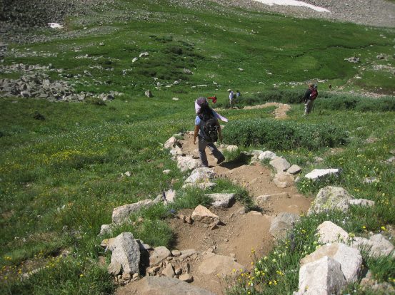
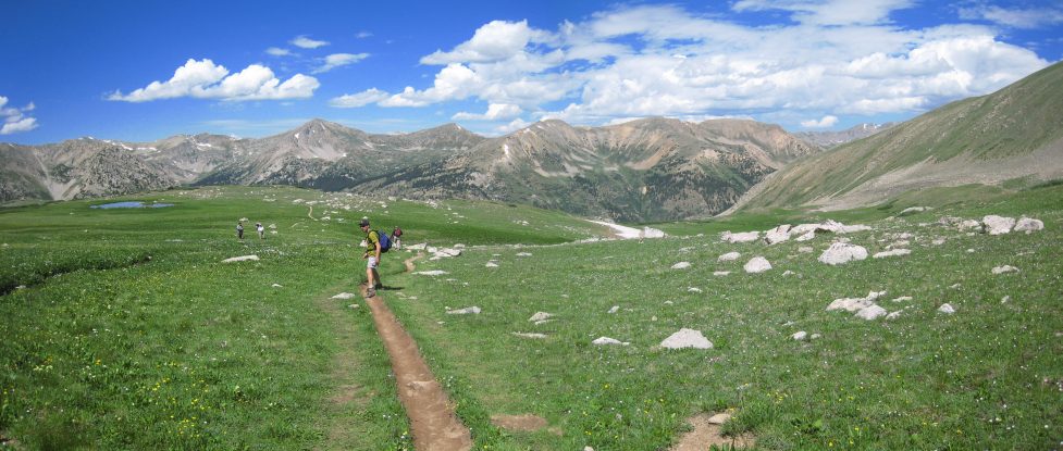
It was still dark enough to use a headlamp at 5am, and the chilly morning air warranted a few layers. We cooked up oatmeal on our gas stoves, and after prepping our bags, began our hike up the 4x4 road from camp at ~6:10am, around sunrise. It was a short .3 mile walk to reach the main trailhead for Huron. All totaled, it would be ~5.5 miles roundtrip, with 3500' gain today.

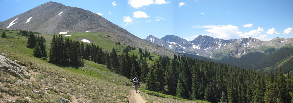
Wendy and Christine walk on the 4x4 road to the trailhead. The meadow on the left had plenty of campsites along the road. Several cars were parked at the end of the road, all high clearance 4x4 vehicles...
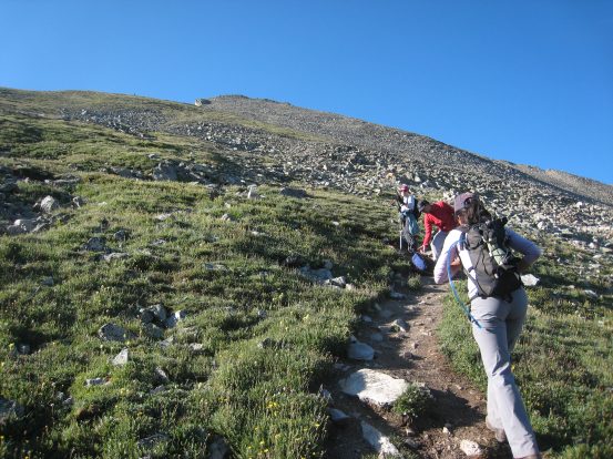
10 minutes after the start of our hike, we entered the forest on the Huron trail...
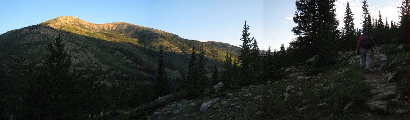
The trail wound through a pretty forest as the sun lit up the east facing mountains...
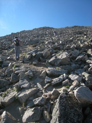
The gentle switchbacks were easy to ascend, and we hiked at a solid pace...
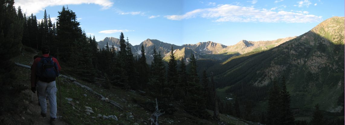
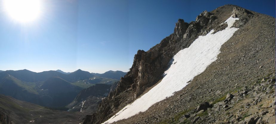
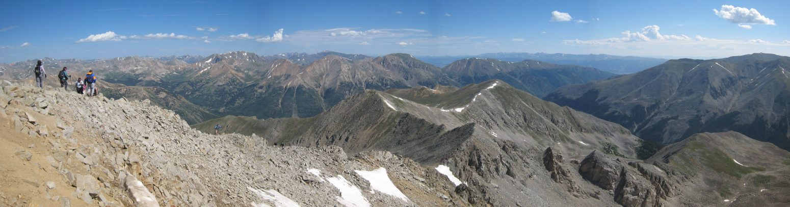
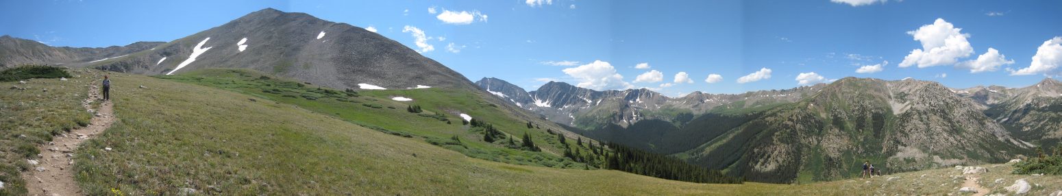
Soon the Three Apostles mountain range came into view, as we gained elevation...
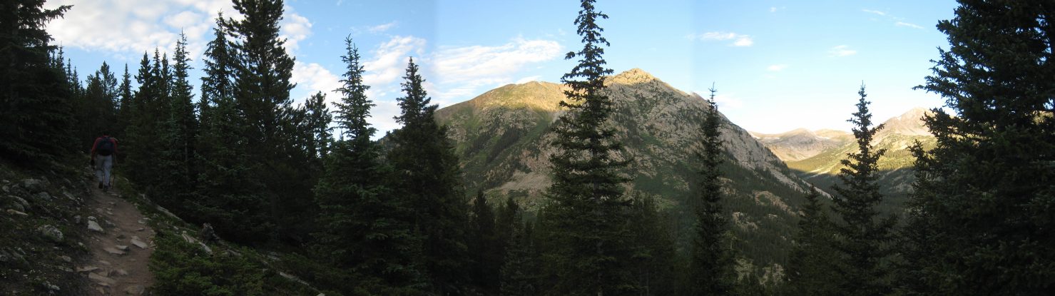
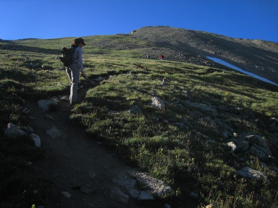
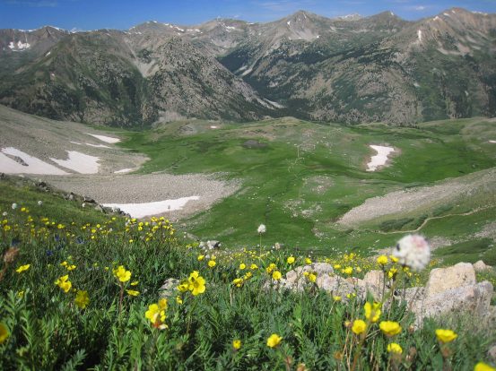
After an hour into the hike we cleared tree line and continued up through the grassy slope...
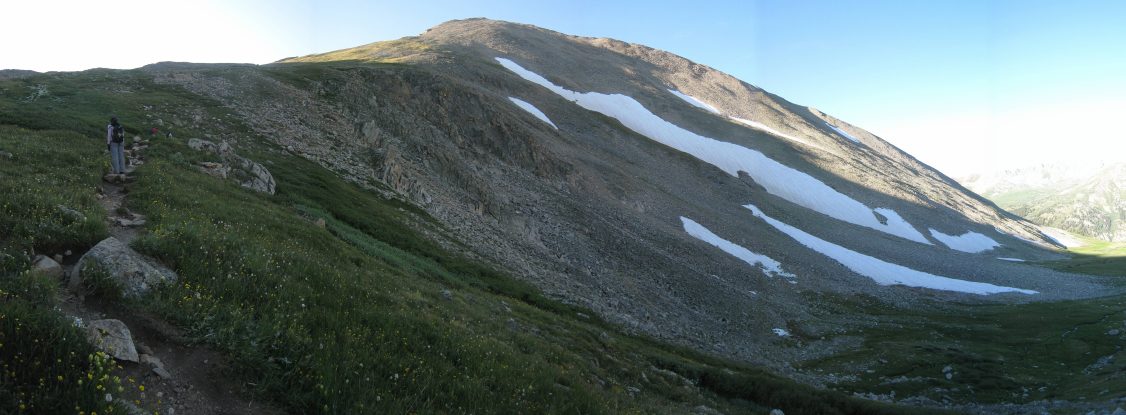
After a couple more switchbacks, we had our first open view of Huron on the left, with the Three Apostles to the right in the distance...
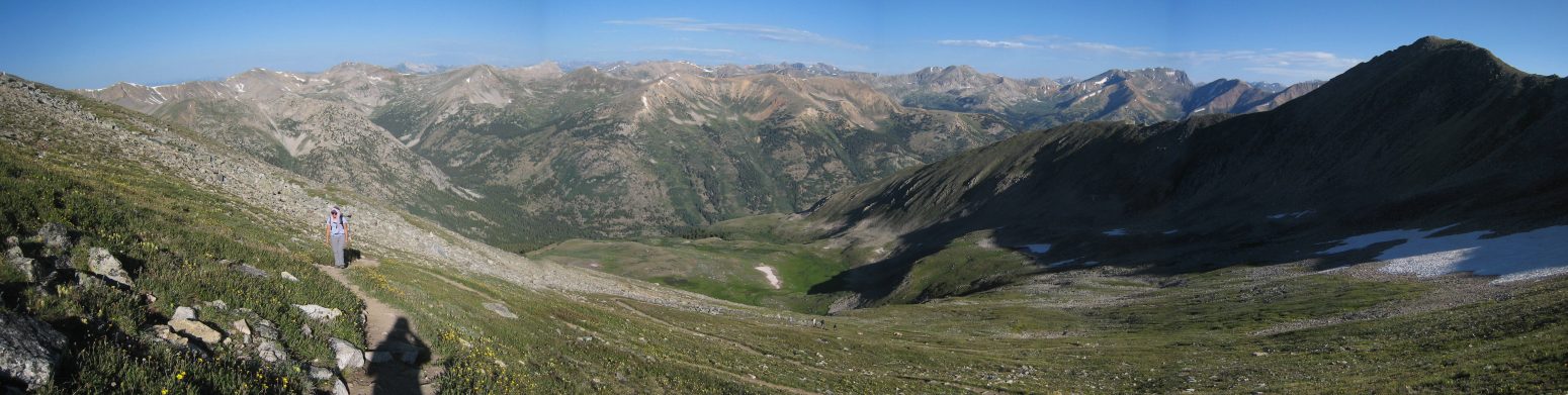
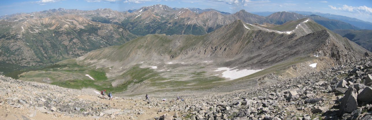
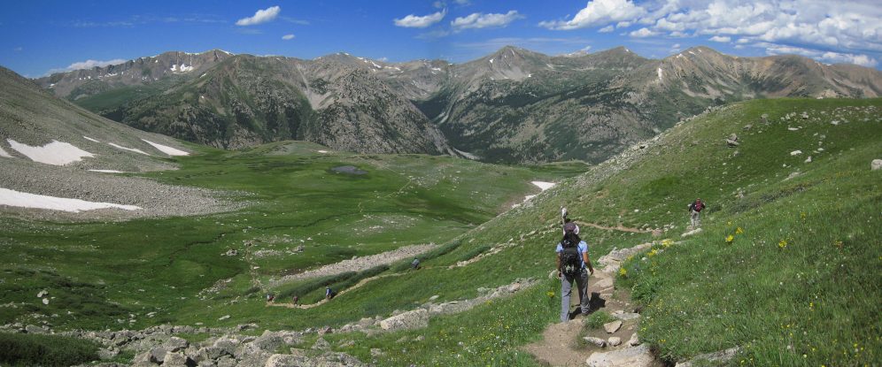
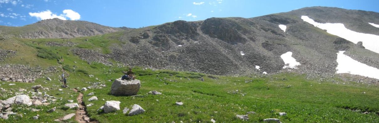
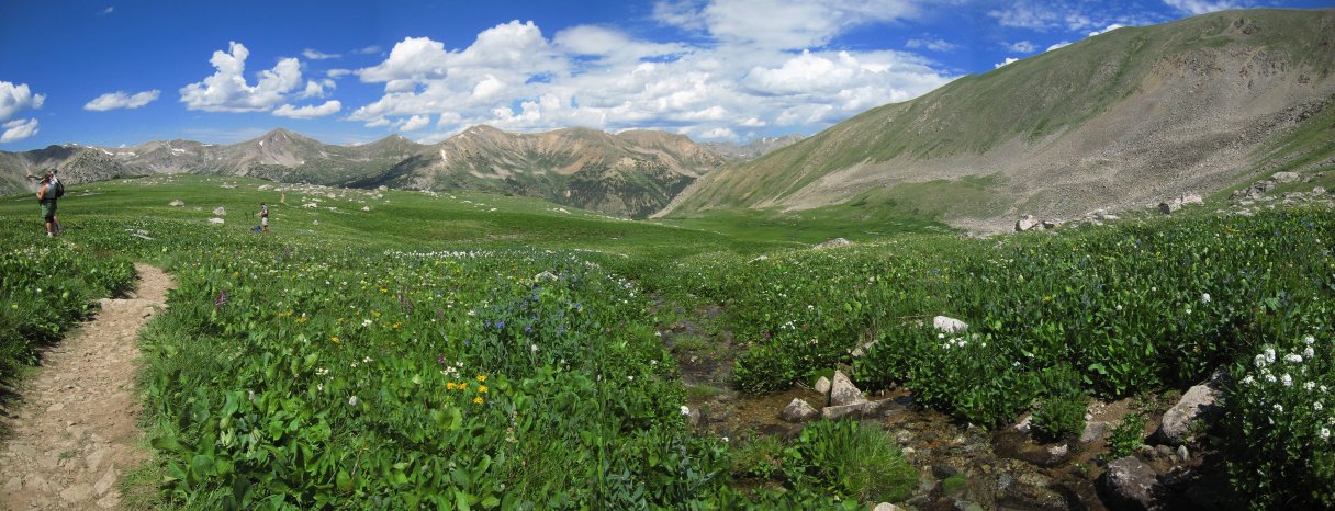
A wide look back towards the valley we originated from. We had reached a grassy basin...
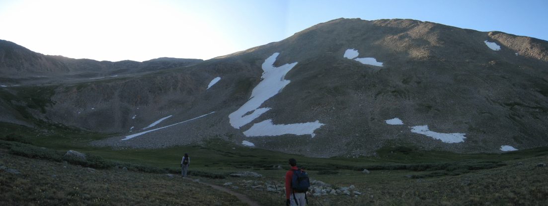
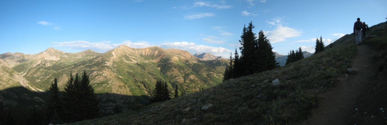
The trail continued across the basin towards the left arm of Huron...
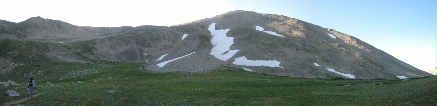
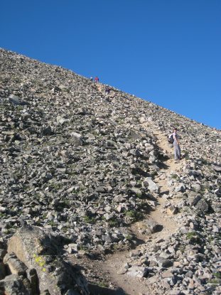
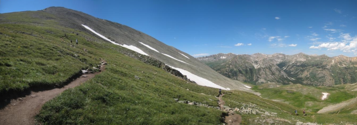
The rest of the trail can be seen here. There was still ~1700' to go...
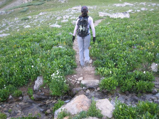
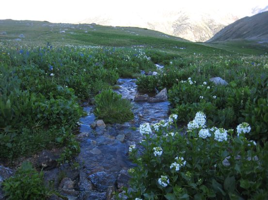
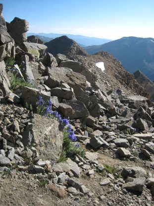
The basin had a stream trickling through it, feeding a plethra of wild flowers on it's banks...
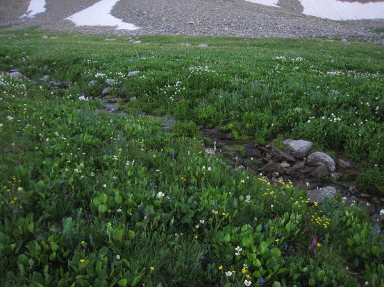
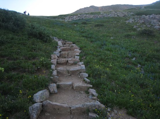
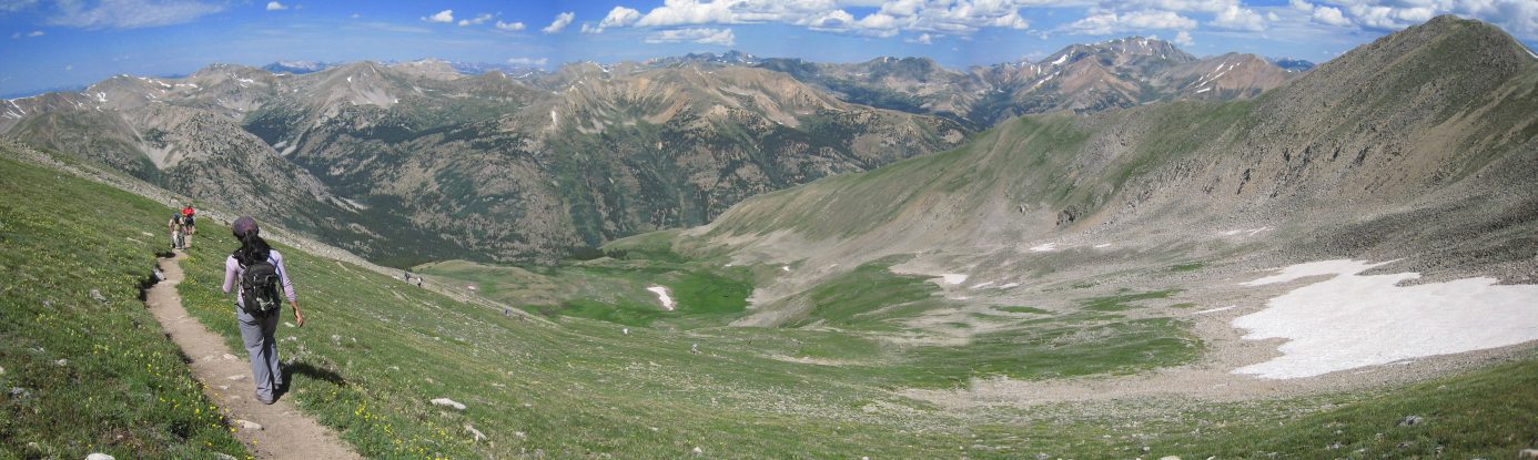
I looked forward to the return trip when the sun would be overhead, lighting up the flowers. The trail was well defined throughout the hike, ascending up some stone stairs towards the left arm of Huron...
Wendy nears the top of the arm, as the basin falls behind below...
It wasn't til about 8:10am that we reached the sunlight. There wasn't much traffic on the trails at this time in the morning...
A look down the grassy arm of Huron. The grassy tundra sure beats a rock scree slope...
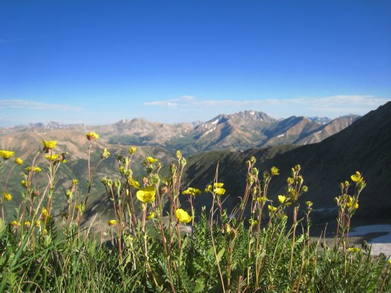
The grass was coated with little yellow flowers. I was impressed with how eye pleasing this hike was...
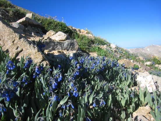
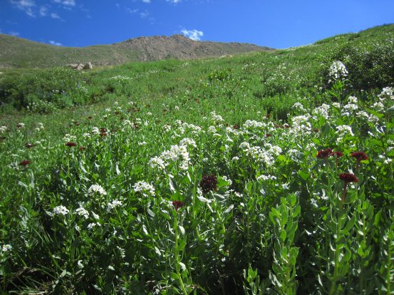
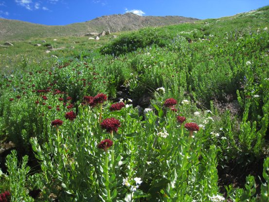
Several other types of flowers bloomed throughout the area too...
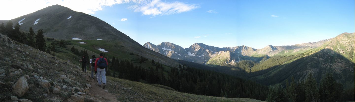
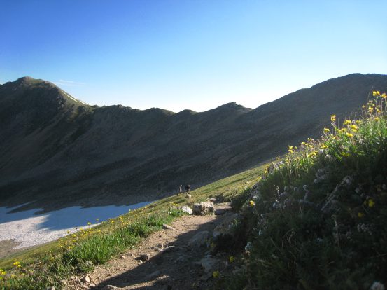
At 8:40am we reached the top of the ridge from the basin on the left, and could see into the adjacent valley (to the right) where we would be camping tonight...
From the top of the ridge, the trail transitioned from a dirt trail up a grassy slope to a steeper dirt/rock trail...
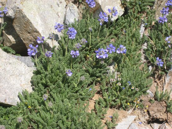
I spotted some purple flowers at the ridge top...
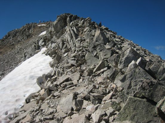
There was still ~500' left til the summit, and it's all rock the rest of the way...
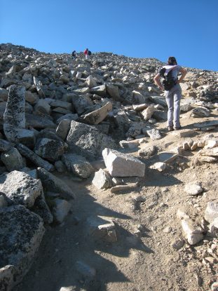
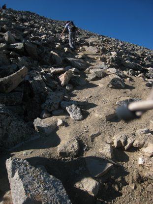
Several looks at the trail ascending Huron. Often it was easier to avoid the slippery steep dirt and scamble up nearby rocks...
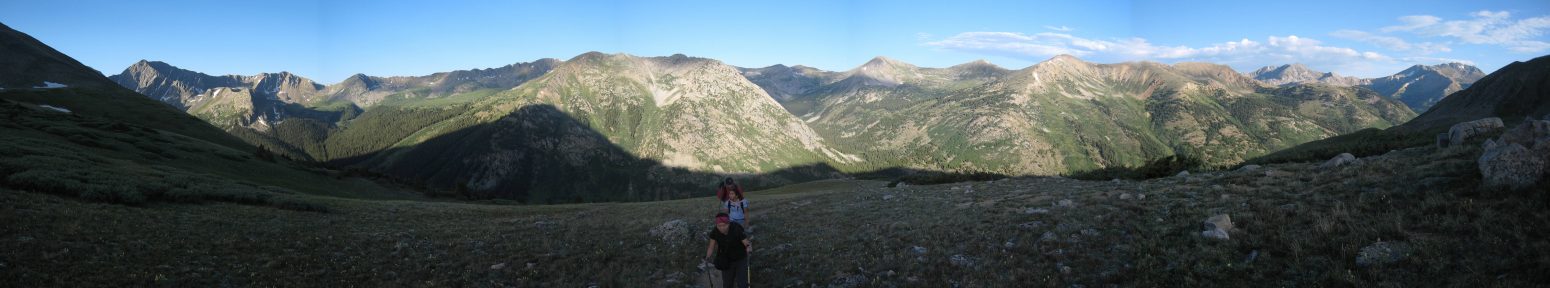
A look back at the valley and basin we came in on...
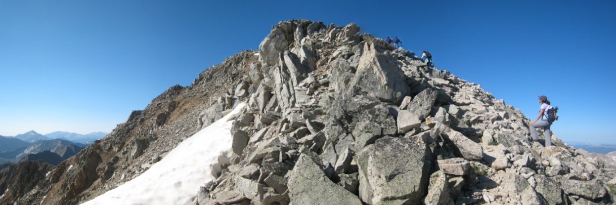
Tom, Christine, and Wendy close in on the summit...
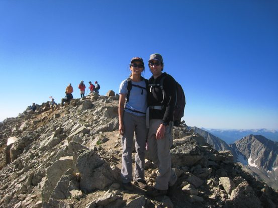
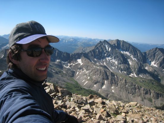
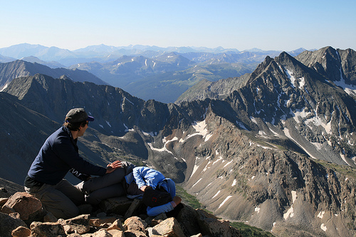
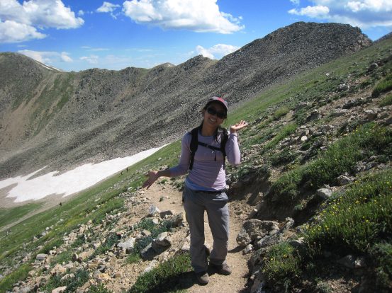
Wendy and I shortly before reaching Huron's summit. We peaked just short of 3 hrs since we started, at ~9:10am. I take a self-portrait with the 3 Apostles peaks in the background...
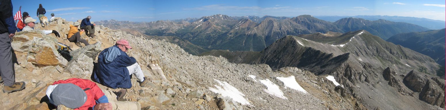
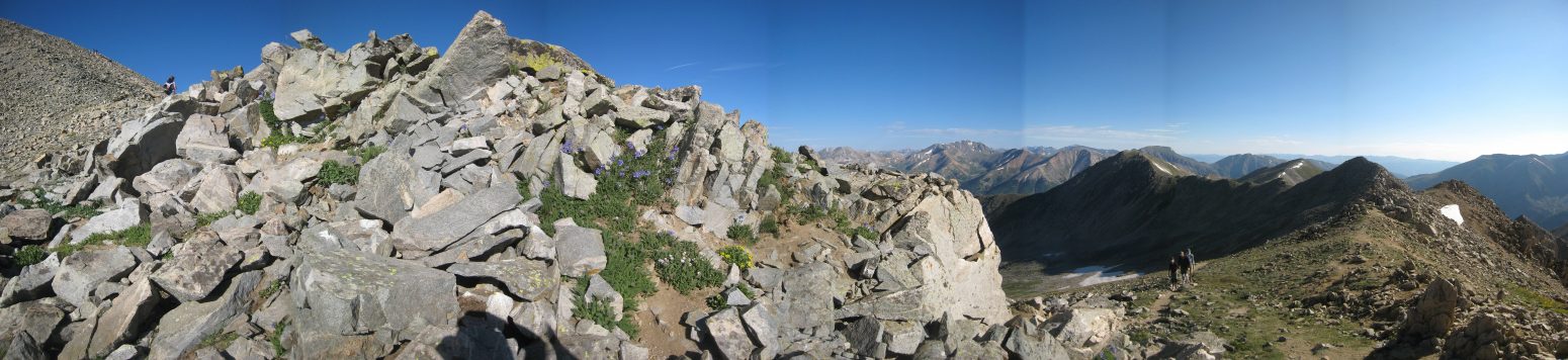
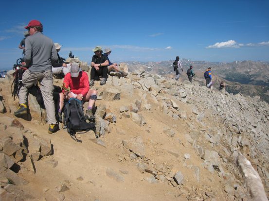
There were ~16 people at the peak when we arrived, including a 10 year old boy (laying down on the left) who had just bagged his 8th 14er. He had climbed Mt. Sherman when he was 4...
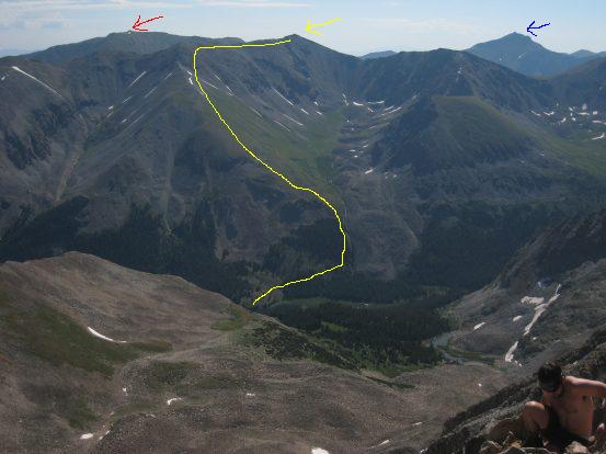
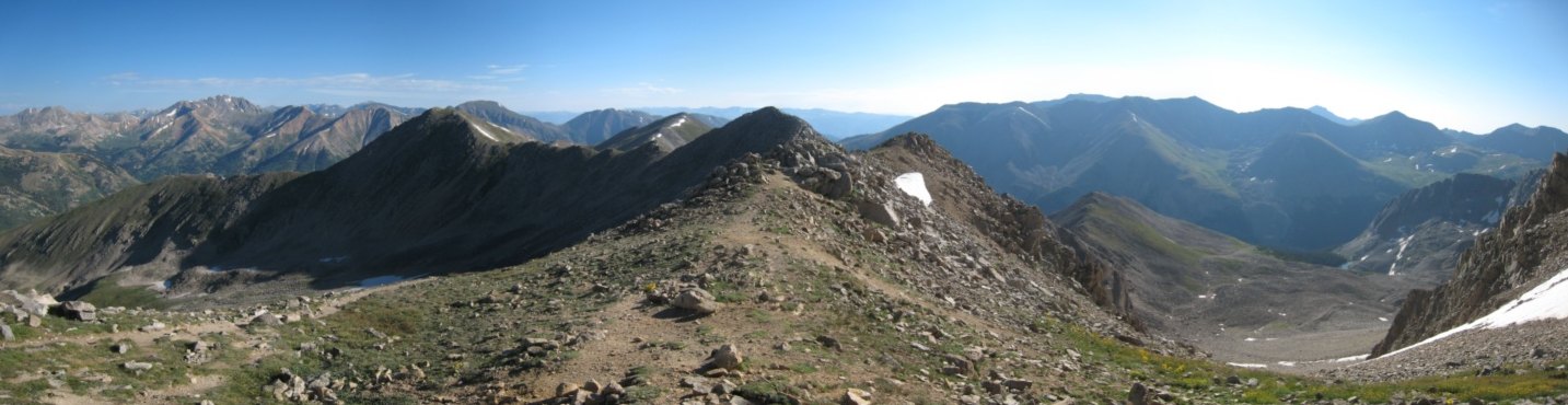
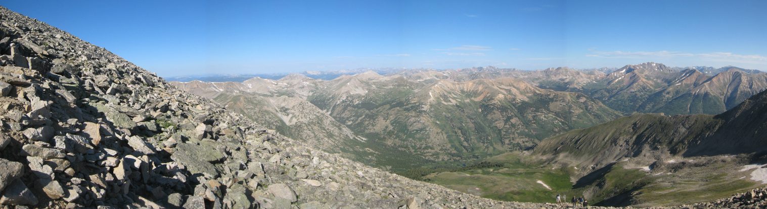
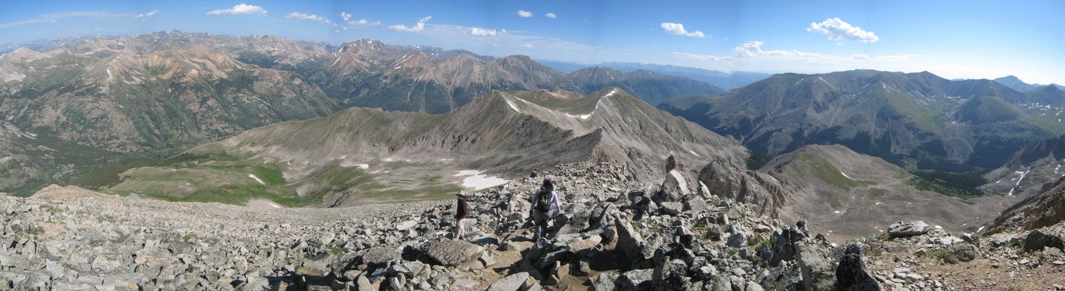
Tom and I, along with others, where trying to name all the peaks in view. There must have been sixteen 14ers in view. Pictured on the left is La Plata. In the right pic, the red arrow is Belford, blue is Harvard, and yellow is Missouri, with our planned route for tomorrow morning's hike highlighted. Ignore the half naked man in the corner...
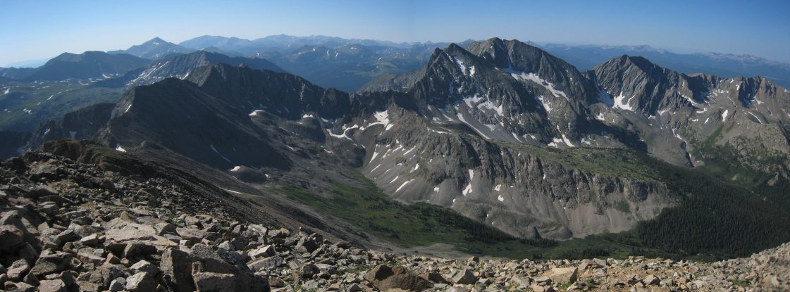
A look to the south showed Mt. Yale on the left, and the Three Apostles looming large on the right...
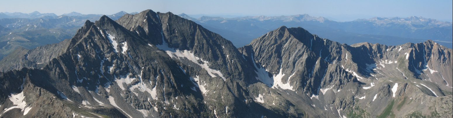
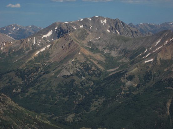
Here's a close-up of the Three Apostles. One of them is 13,950', nearly a 14er. Ice Mountain in the middle is known for it's snow coulier, called "The Refrigerator"...
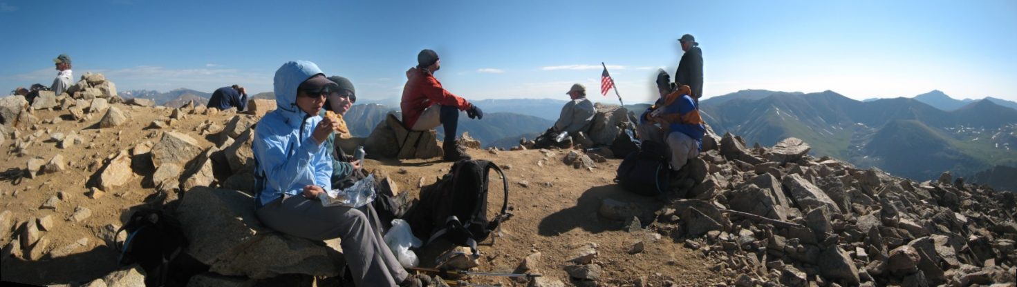
We ate our lunch at the peak. I hope Tom's sandwiches turned out ok. It was pleasantly chilly at the top. Beats air conditioning back in town on this 100 degree day along the front range...
Wendy had me stretching out her IT band on her leg before we began the descent at 10:05am (Christine's pic). Many more people were streaming in, and Tom counted 35 people on the summit as we left...
What a gorgeous morning. The forecast was for 20% chance of storms after noon, both today and tomorrow. Great weather for the mountains...
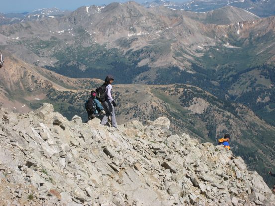
There was a short ridge walk from the peak, before the trail began the steep windy descent on the dirt trail through the rocks...
The views were great coming down, though our eyes were mainly on the dirt trail in front of us as we paused now and then for ascending people to pass...
Sometimes it was easier to scamper down the rocks off the side of the trail, but the dirt trail was actually not too slippery for the most part if you kept light on your feet...
Once we reached the grassy slope, the trail was a breeze and very scenic with the green grass, yellow flowers, and blue sky...
Wendy poses on the trail. A big bee was doing business in this yellow flower...
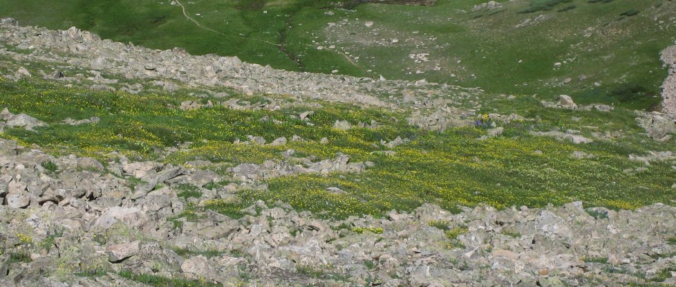
A look down the slope at a particularaly dense field of yellow flowers...
A look back at Huron from a bend in the trail...
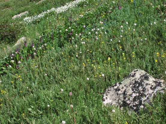
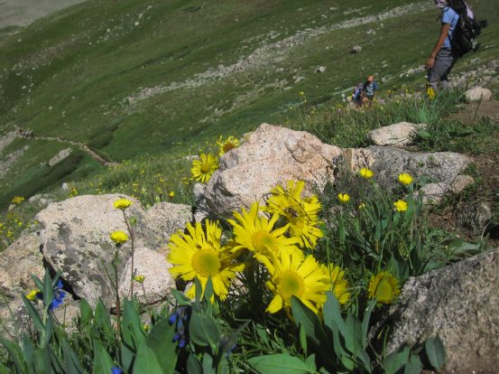
The yellow flowers were everywhere on the slope, and various other colored flowers emerged along a creek running down the mountain...
Plenty of white and maroon flowers here along the creek...

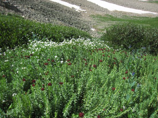
The creek was small, but created a vein of wild flowers running down the mountain...
A look down as we approach the basin. Tom was way ahead, resting on a rock at the bottom...
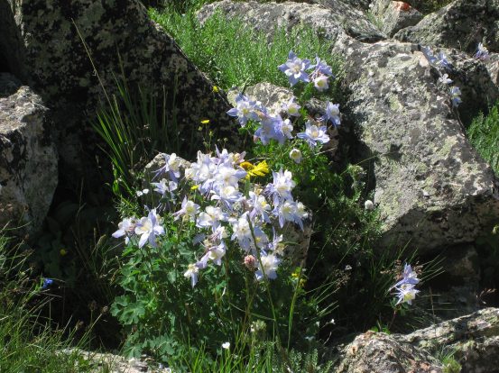
Some columbine joined the flower party as well. What a well built trail this was. Very accessible to anyone. No wonder we kept passing hikers on their way up all day...
Here's Tom sitting on a rock, as Christine arrives. He was in a t-shirt and shorts when we met up with him. Huron looms large on the right...
Tom looks back as we head across the grassy basin...
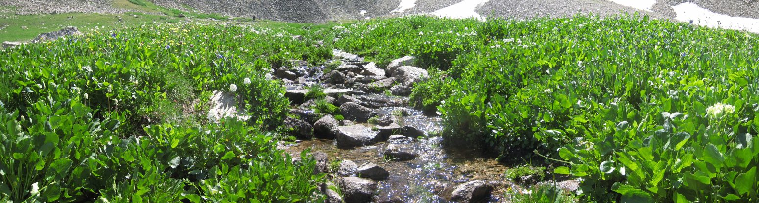
We reached the creek running through the basin, and I stopped for quite a while to take photos of the wild flowers. Here is a look facing upstream...
And here's a look downstream. All sorts of colored flowers were abound...

I caught back up with the others near the end of the basin...
A 180 degree view from the end of the basin. Christine on the left, Tom and Wendy heading down on the right, Huron in between...
Soon we headed back into the forest, where we'd lose sight of Huron and the Three Apostles, and take the switchbacks down through the trees back to camp...
We only passed one group of hikers ascending to Huron along the switchbacks, so most of the ~120 hikers we saw all opted for early morning starts. We ended up back at the 4x4 trailhead around noon, and walked back along the road until we found our camp. We all thought this walk on the road back to camp was much longer than it seemed in the morning, and were glad we didn't have to hike the full 2 miles out on the 4x4 road.
We packed up camp and were on the road again at 1pm. We all enjoyed the beauty of the hike to Huron, and both Wendy and Christine considered it one of their favorite Colorado hikes. Tom drove us down the 4x4 road without incident, and we stopped in Winfield to check out the ghost town buildings before continuing off to Rockdale for a much more serious 4x4 drive up to Lake Cloyses where we'd camp tonight and attempt Missouri tomorrow morning. But that story deserves a web journal of it's own...
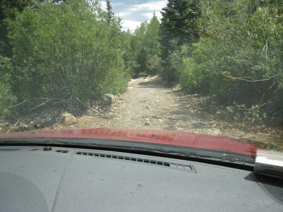
A look out the windshield as we travel back down the 4x4 road to Winfield. Part of stream was running down the road there, but it was just an inch or two deep...
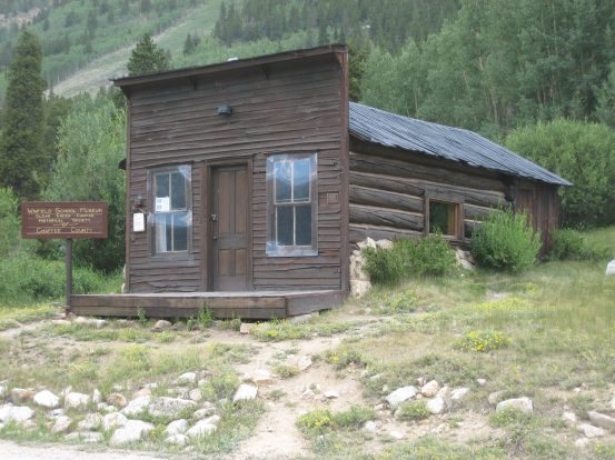
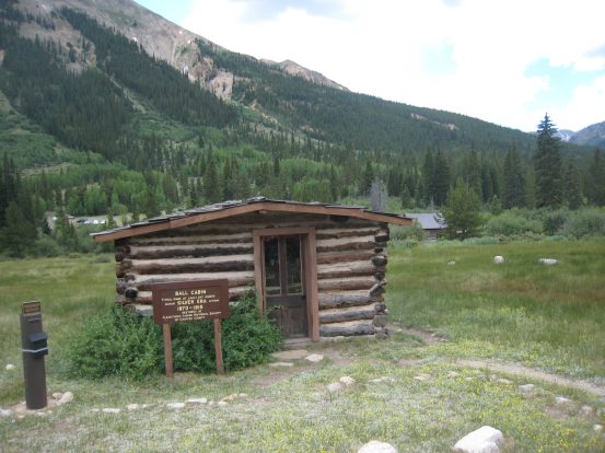
The old Winfield school building and a cabin decorated with a 1870s interior were left to remind us of the old days when this town had a population of 1500 people in the late 1800s. It had three saloons, an inn, a post office, and school. Hard to imagine a town that big existing so deep in these mountains...
Continue on to the Missouri Mountain web journal