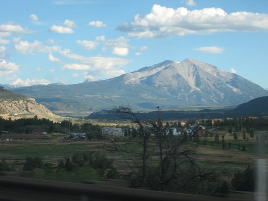
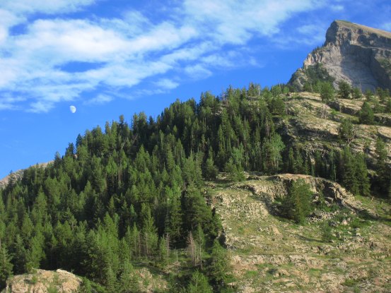
As we head south from Glenwood to Carbondale, Mt. Sopris, a 12er peak, looked very powerful ahead. We wondered what peaks popped up from behind on its left, as Captiol Peak resides in that area...
As we head south from Glenwood to Carbondale, Mt. Sopris, a 12er peak, looked very powerful ahead. We wondered what peaks popped up from behind on its left, as Captiol Peak resides in that area...
After driving through Marble, we headed up the 4x4 road, which was just as rough at the beginning as I remembered. We bounced around, and after ~10-15 minutes made our way to junction for Crystal. We would be taking the gentler north road (still 4x4) straight to Lead King Basin, rather than the harrowing route via Crystal. Tom's tire pressure light popped on early in the drive, so he took the opportunity at this large intersection to double check the tires. Carl and I were surprised when he said there was a flat!
We emptied out the trunk, to access the spare tire, and we helped Tom change the tire. A few cars came from the Crystal road, but were able to bypass around us. I noticed the flys and mosquitos were aweful here, which is the first time this year when that's been the case. After ~30 minutes, the tire was changed, and we had to decide whether or not to continue without a spare. I remembered the rest of the road wasn't too bad, and we decided to continue, at a slow and careful pace. It was already past 7:30pm when we took the left hand turn up the "5 mile" road to Lead King Basin (the road was more like 7 miles according to Tom's odometer).
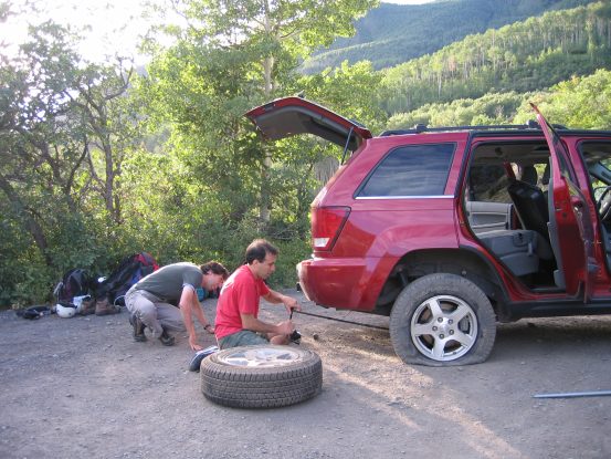
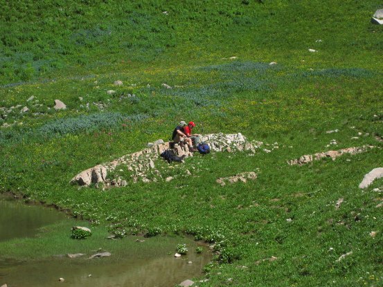
Ahh... The unpleasantness of dealing with a flat tire enroute to camp. It was surprising to find the flat, as the road wasn't THAT bad, but it looked like the tire got pinched on a rock at some point. Carl took the pic on the left...
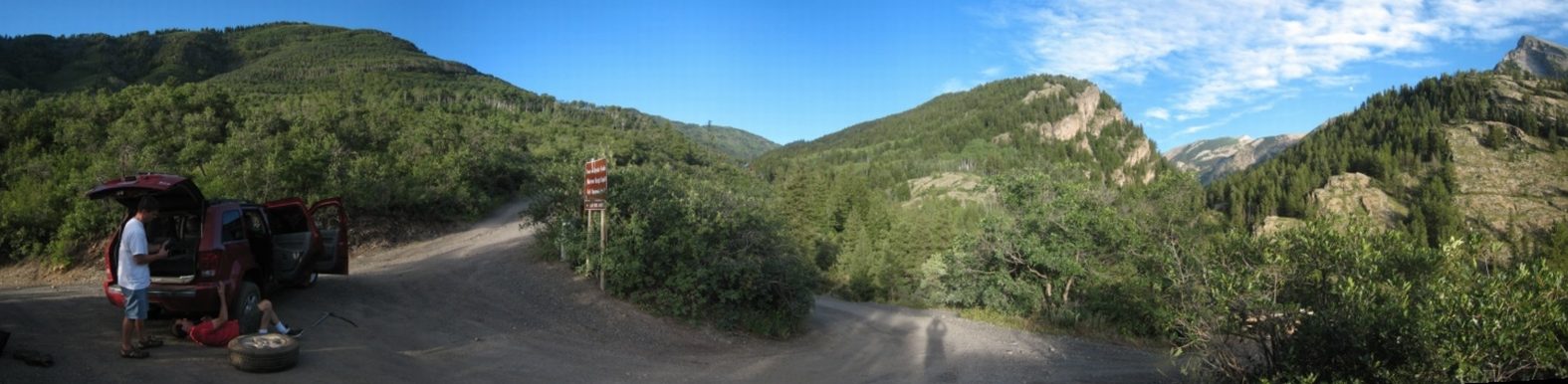
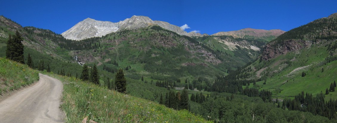
The road here was wide enough to allow other vehicles to pass. We'd be taking the road on the left to Lead King Basin. The road on the right goes to Crystal, where there is a connection up to Lead King Basin as well, but that road is REALLY nasty...
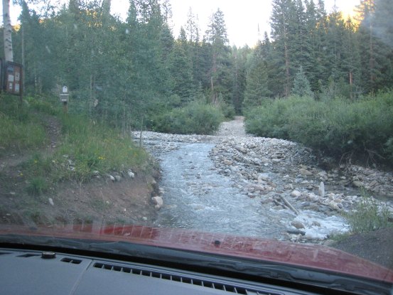
The moon was up ~7:30pm, as we hit the road again. We came upon a stream crossing 10 minutes later, which wasn't too deep, but had some nasty bumps on the far end...
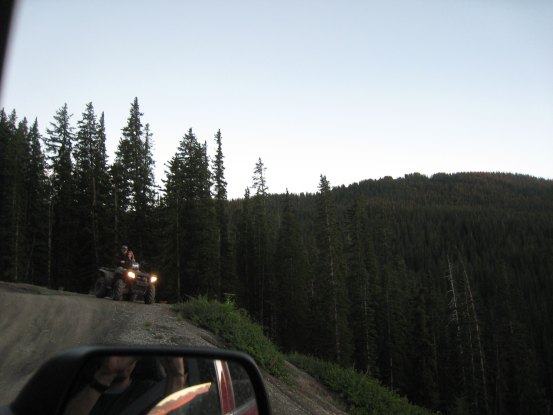
The road took much longer than we anticipated. ~40 minutes into the drive, we crossed paths with an ATV. The guy said there was still 2.5 miles left. The sun was now setting behind us to the west. We got a few good looks at the horizen as we drove up the switchbacks...
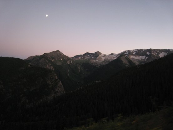
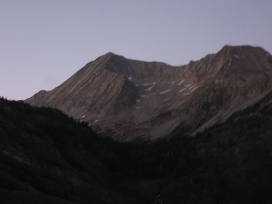
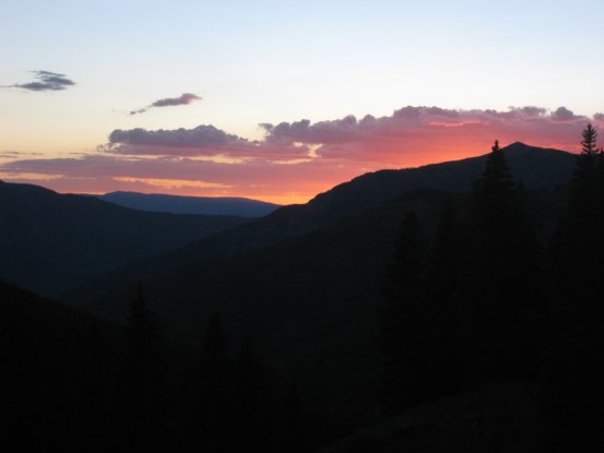
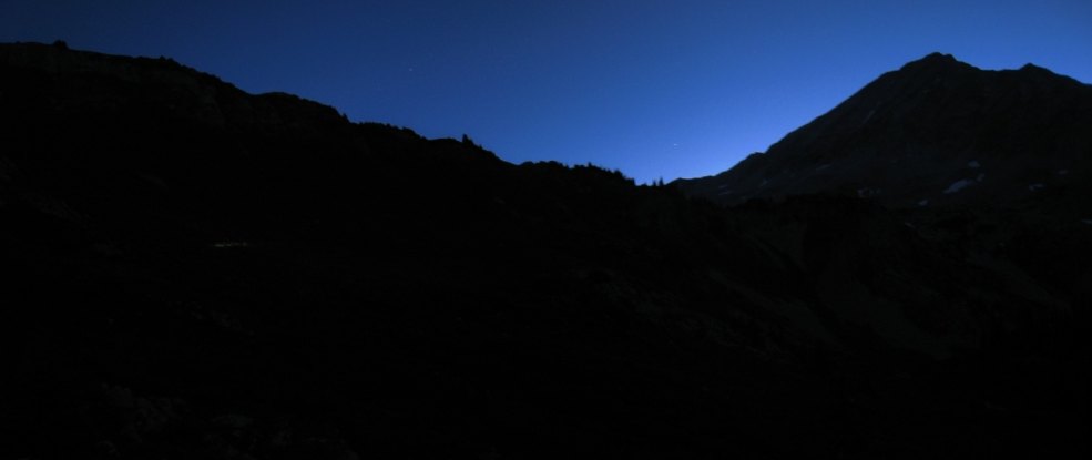
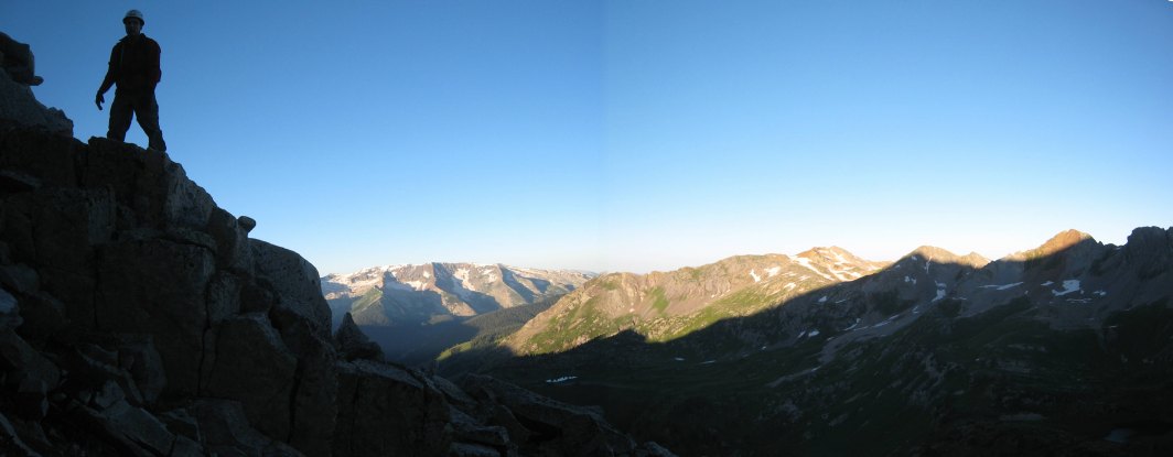
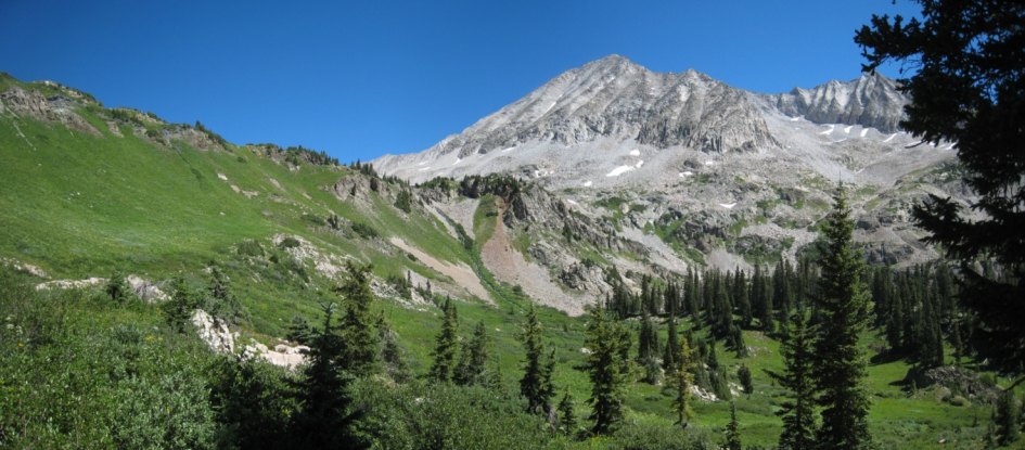
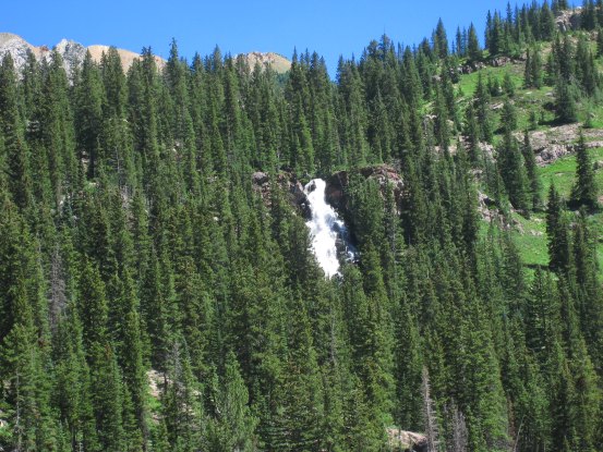
In another 15 minutes, we had topped the large hill and had views of Snowmass and the Lead King Basin below. It was getting dark, and we'd be descending the final switchbacks with hardly any daylight left. The S-Ridge is easily seen snaking up Snowmass, and looks intimidating from this vantage point. Too bad we had the flat tire, as 30 minutes ago this scene would have been lit up in alpenglow...
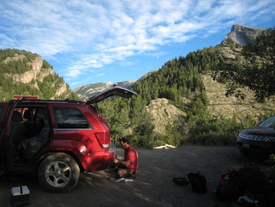
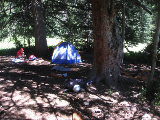
It was ~8:45pm when we pulled into the Lead King Basin trailhead, where just one other truck was parked. The camping spot where Dave and I set up camp two years ago was open, so we walked into the trees, near the parking lot and set up our tents in the dark. We agreed on a 3:15am wake-up call, hoping to get on the trail by 4am. The sky was totally clear, and the moon was bright to the south, just above the mountains. It was surprisingly warm as we went to bed ~9pm. I stayed up til 10pm, and brought a crossword puzzle to try to help myself sleep. It worked...
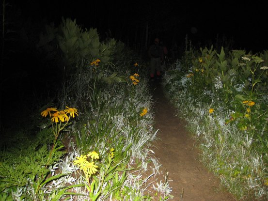
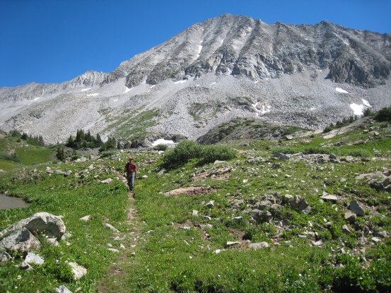
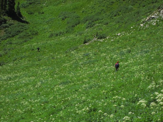
Two years ago, the dense vegitation was drenched from a storm the previous night, which quickly soaked our pants, socks, and shoes. This year was much more pleasant and dry. We caught glimpses of plenty of wild flowers along the trail with our head lamps, and could only wonder at the beauty in store for us later in the sunlight...
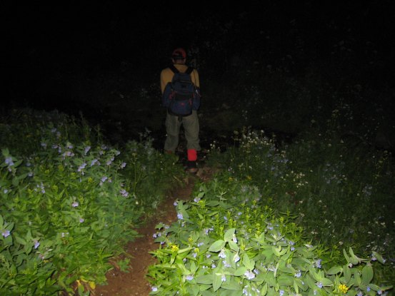
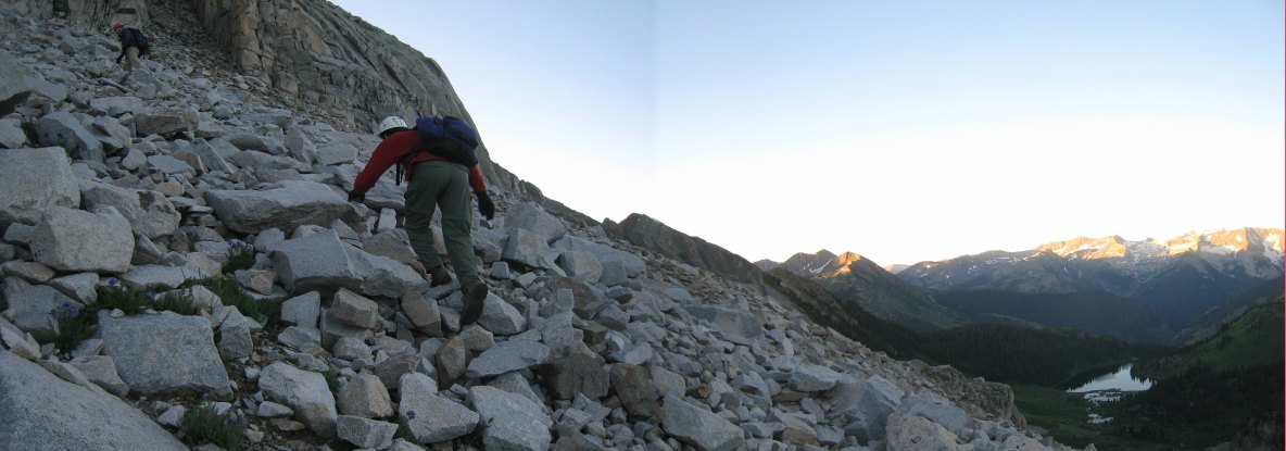
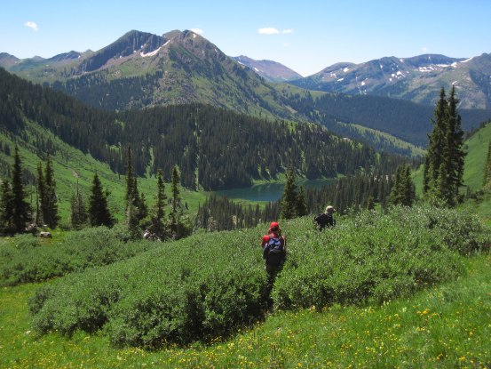
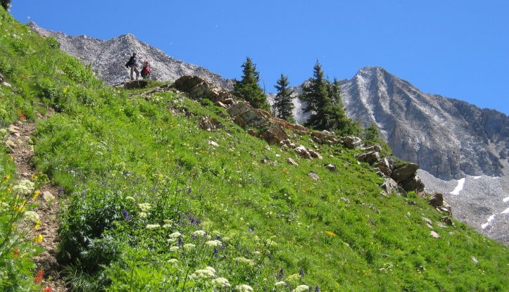
At 5:30am, it was light enough to attempt a pic without a flash, but it wasn't until 5:45am that we turned off our headlamps. A very feint white streak on the left side is the head lamps of Tom and Carl. We were making great time up the valley. Snowmass towers on the right...
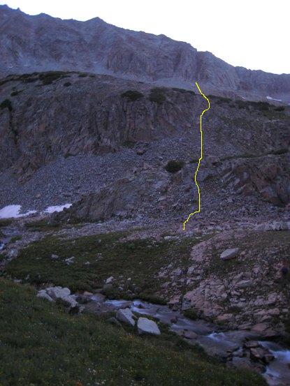
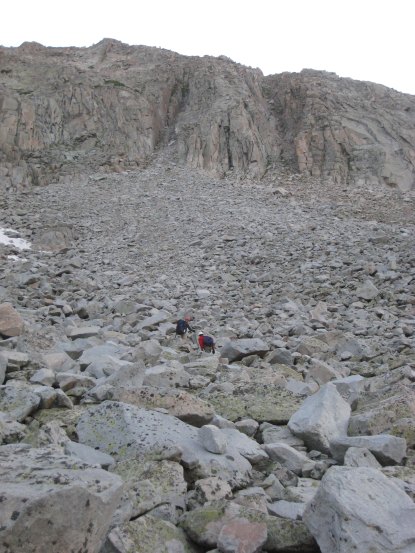
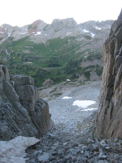
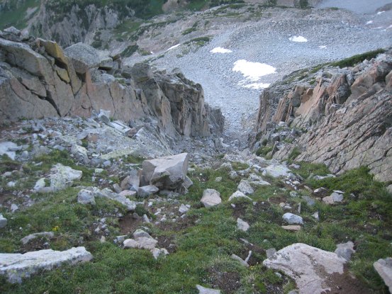
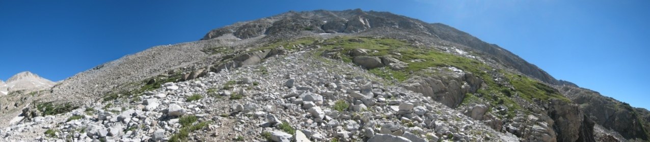
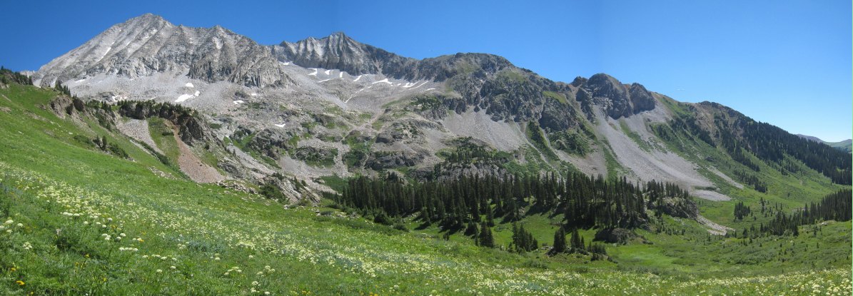
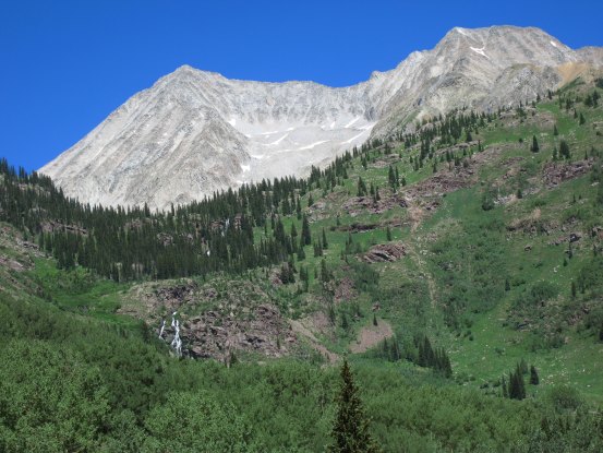
After ~1.5hrs, we reached Gem Lake. Roach says to cut towards Snowmass just before Gem Lake, so we angled our way down the grassy slope to the stream. Two years ago, Dave and I ended up crossing much further past Gem Lake, and back tracking to the S-Ridge couliers. This time we were more efficient and crossed right underneath the couliers. It was easy enough to scramble straight up the rock as shown in yellow...
Tom nears the end of the grass. It would be all rock scrambling the rest of the way...
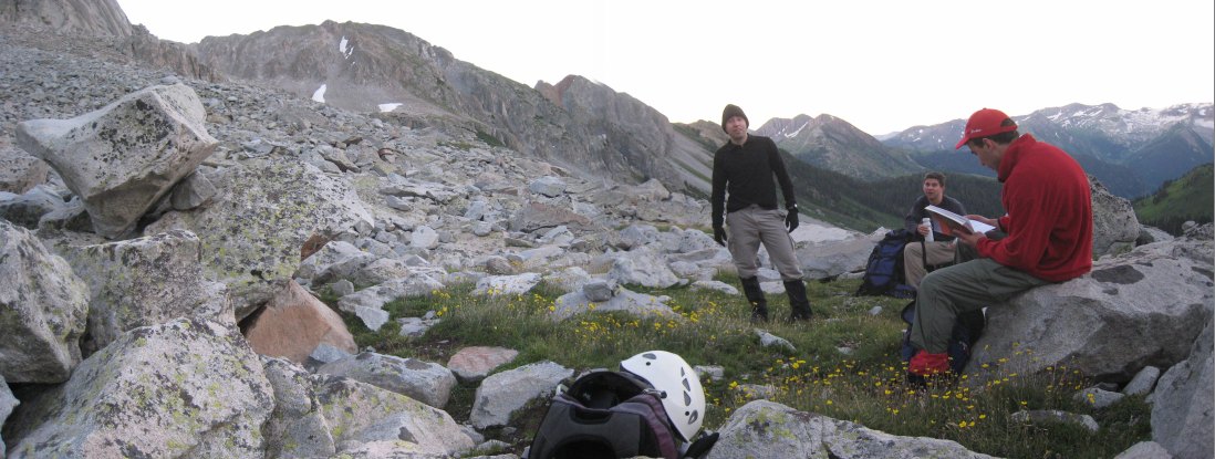
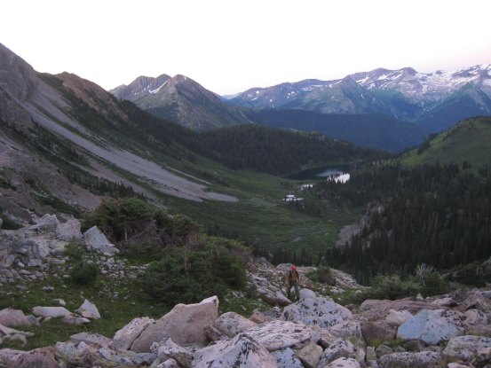
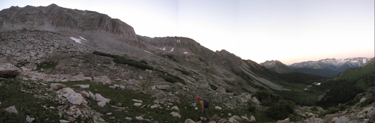
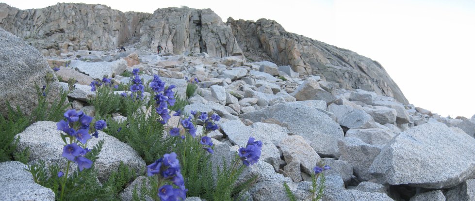
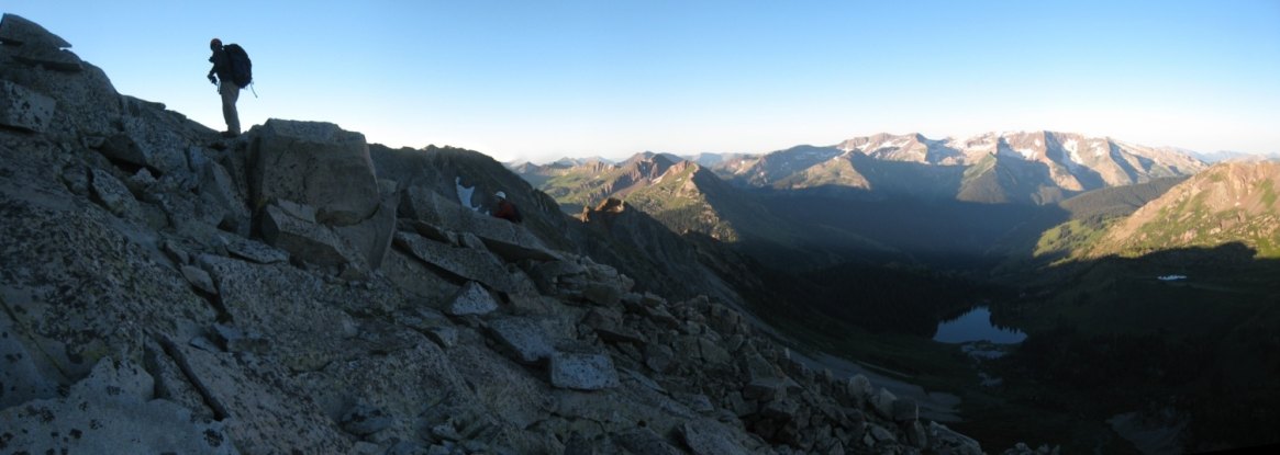
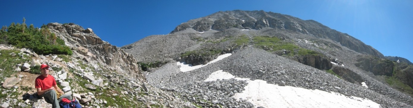
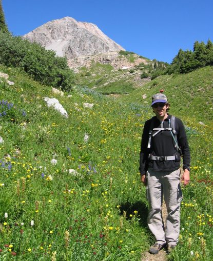
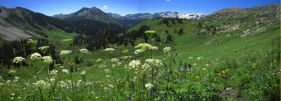
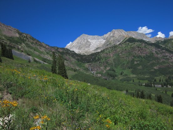
I set up the tripod for this stitched pic while we took a rest. Tom brought the big heavy Roach 14er book during the hike. Some yellow flowers here...
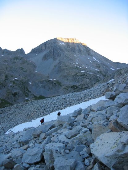
Two years ago, Dave and I ascended via the right gully, which was supposedly easiest, but the left gully had looked pretty good too. This time I wanted to try the left gully, and Tom and Carl graciously went along with it. Carl's pic on the right, of Tom and I ascending, as the sun reaches the tip of the mountain behind...
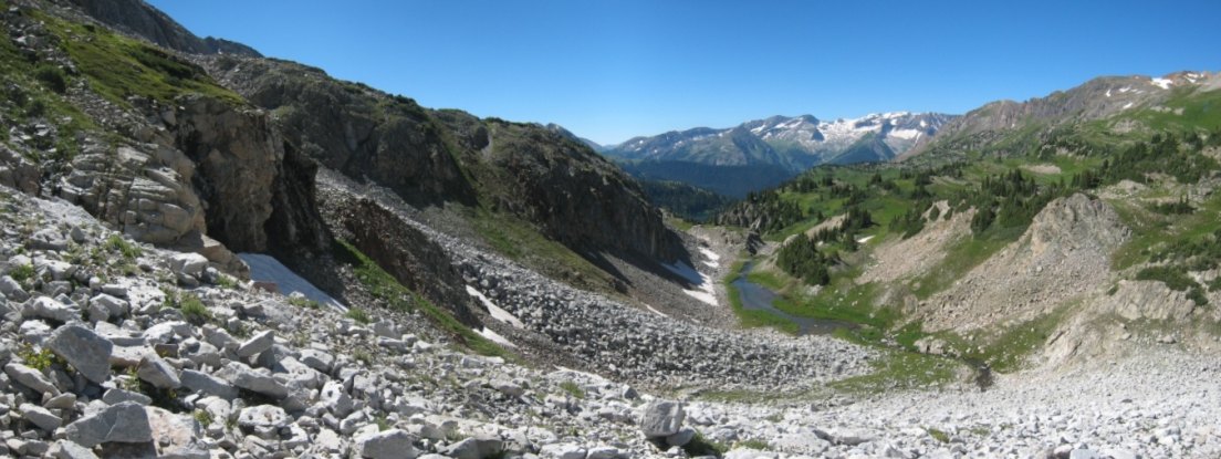
At 6:35am, we approached the gully. Geneva Lake sits back in the basin to the right of Tom...
The right gully appears in the upper left of this pic. I was excited to explore the left chute this time...
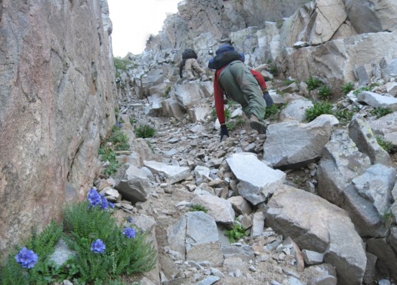
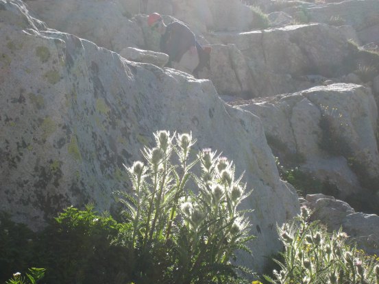
I stopped to photograph some flowers, as Tom and Carl continued towards the left chute...
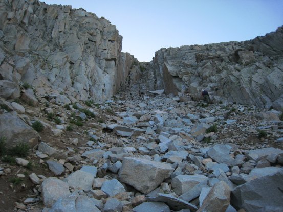
A look up the left gully. Carl leads on the right...
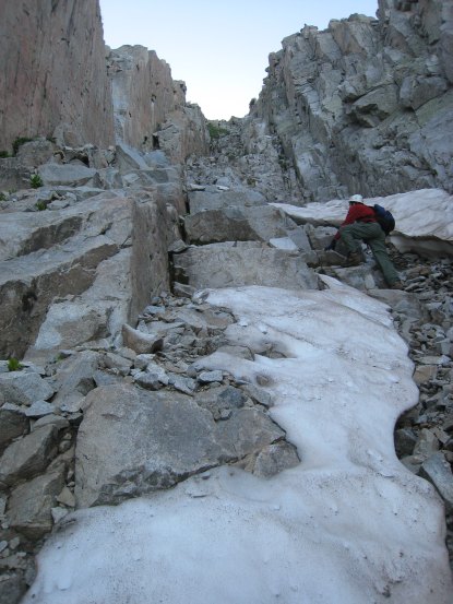
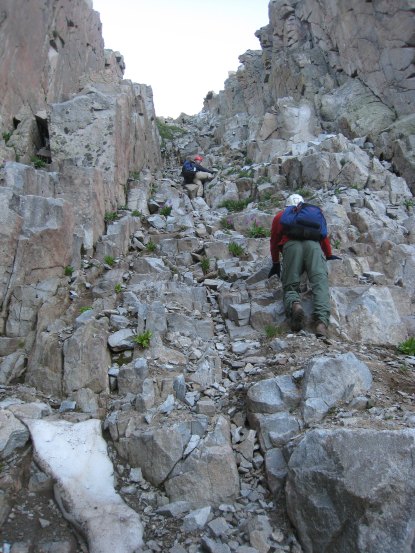
The gully started out pretty simple, but soon we encountered lots of loose rock and dirt. Any dislodged rocks funneled down main route up, so we had to be very careful...
I spotted some flowers along the side. Having ascended both gulleys, I'd recommend the right one, especially if going with a group, since it's a bit wider, and there's better rock along both edges of the gully there.. In addition, the right one tops out at the ridge sooner...
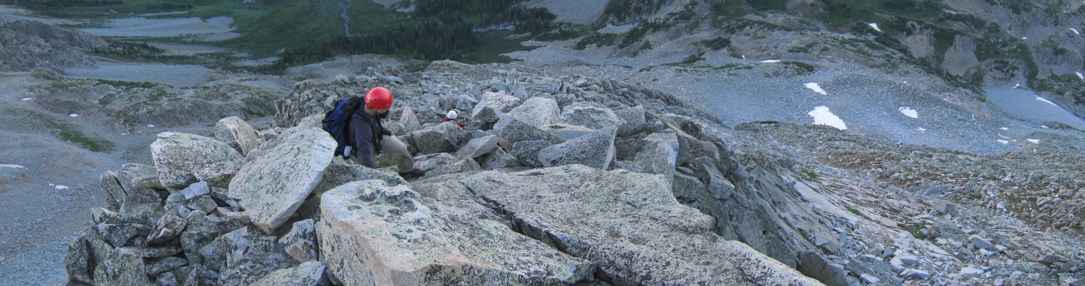
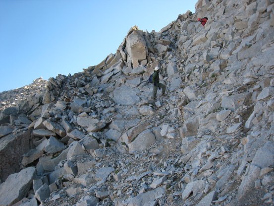
Tom stands tall at the exit of the gully...

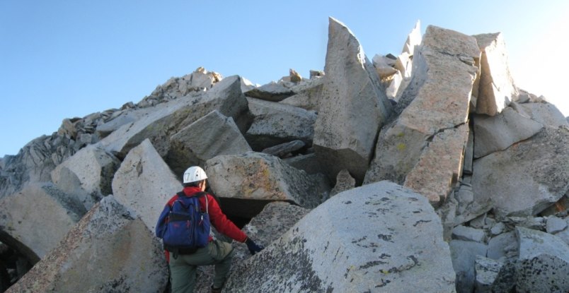
At the top of the gully there was a brief grassy patch, and then another rock scramble to the top of the ridge. A look down the gully, and a pic by Carl of me scrambling up to the ridge...
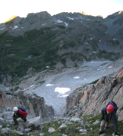
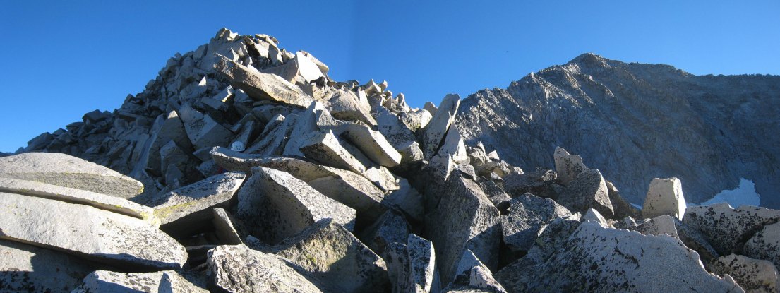
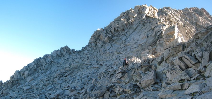
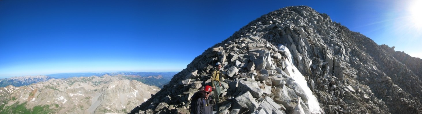
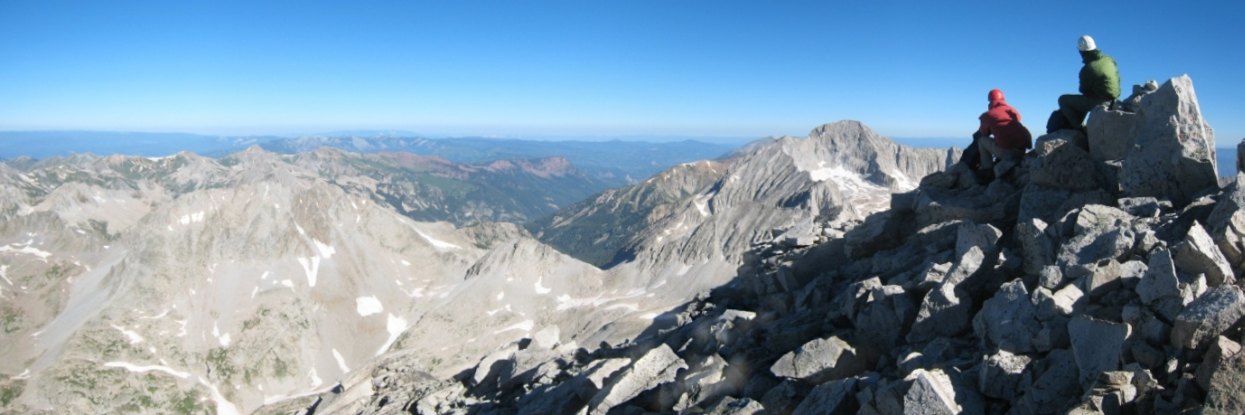
Carl stands atop the ridge. We reached the ridge crest at 7:05am, almost 2 hours since the start of our hike...
Once on the ridge, the rock was much more solid, with larger boulders. Carl looks back towards Tom...
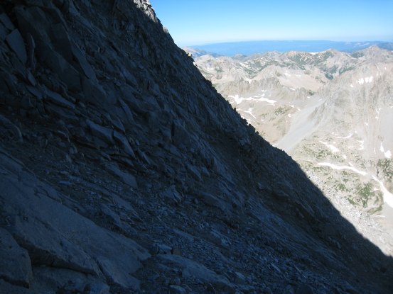
A look up the ridge. The sun was still hidden behind the Hagerman ridge. The peak of Snowmass is not visible yet...
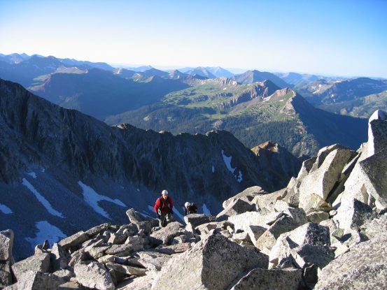
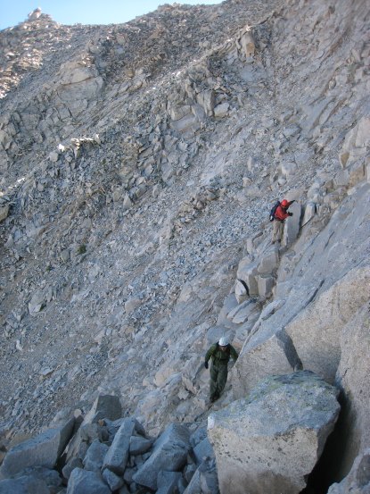
Carl continues the climb. I stayed on the ridge top as much as possible, but it's possible to stay off to the left frequently...

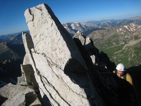
Carl takes a photo of me on the ridge. I remembered the large spikey rock up ahead, which was lit with the emerging sunlight...
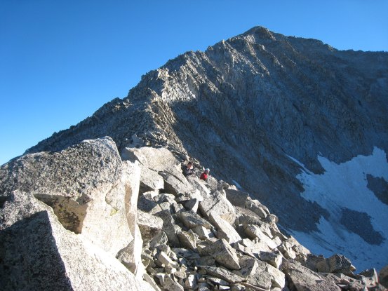
Tom climbs the next scramble pitch, just below the sharp pointy rock...
Just beyond that pointy rock, we get a view of Snowmass's summit, and we emerge into the sunlight for the first time today...
A look back down the S-Ridge's spine, the pointy rock easily seen on the left...
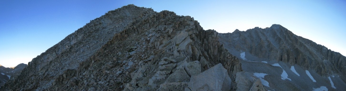
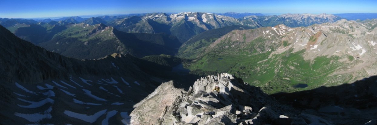
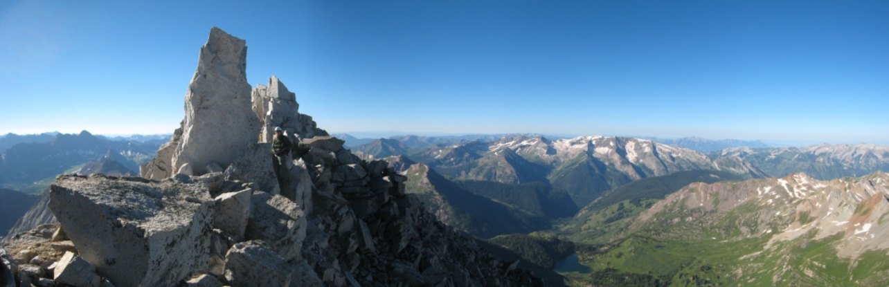
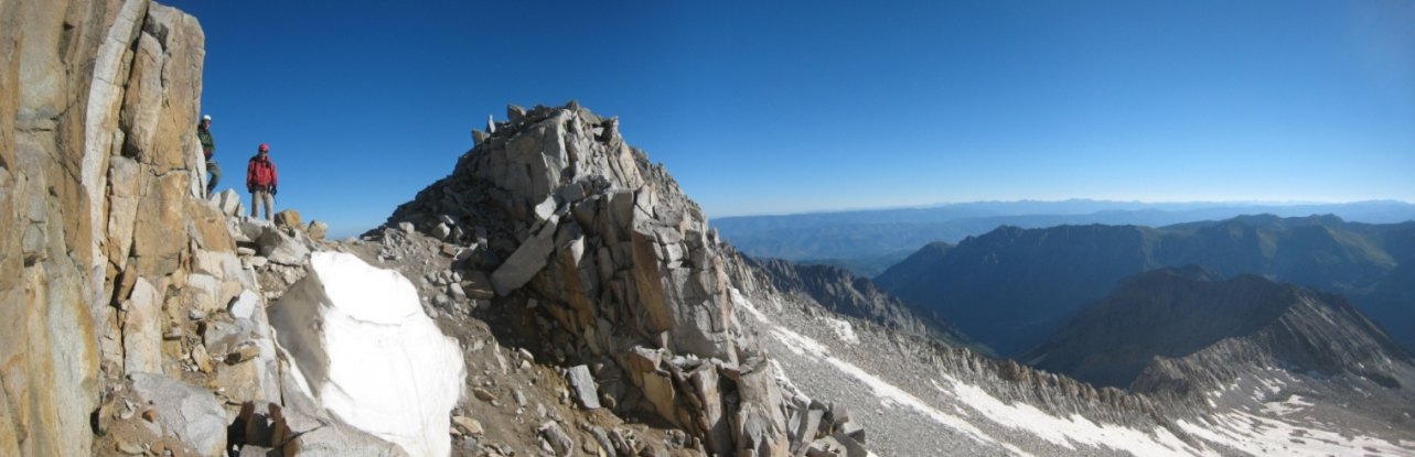
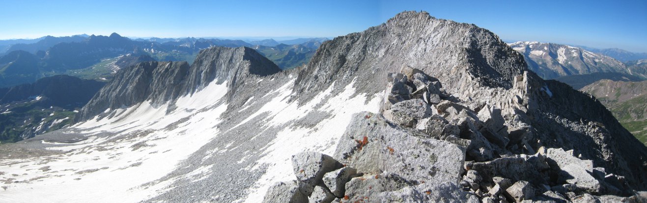
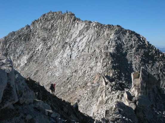
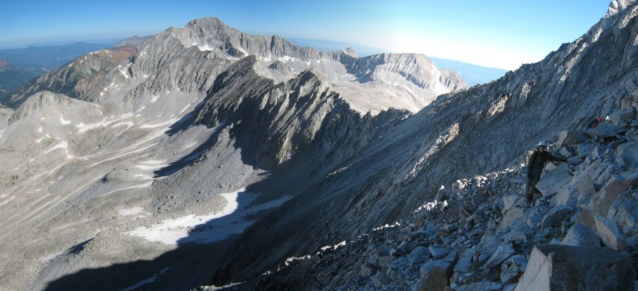
We take a short break as the curve in the S-Ridge offers a complete look up the rest of the ridge...
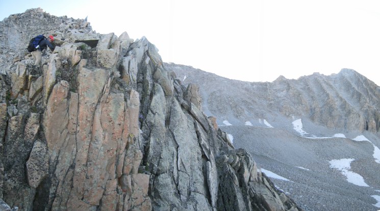
Here's a look at the buttress crux of the route. There's an easy bypass off to the left (the notch) where Carl is heading. Tom and I stuck to the ridge, which turns class 4 here...

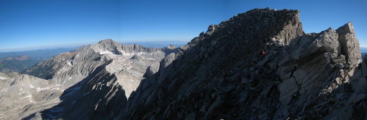
Tom climbs up and over the buttress. Again, no need to go this route, as a simple class 2 route side skirts it (with a slight descent), but I stayed on the ridge last time, and knew it was passable...

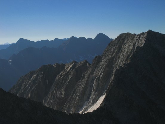
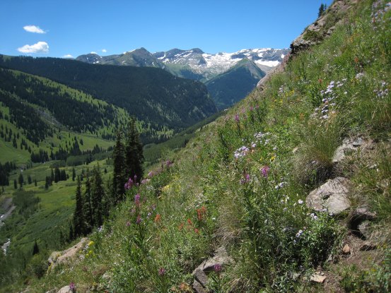
A look down the ridge, and off to the southeast, where the Maroon Bells and Pyramid peak popped into view...
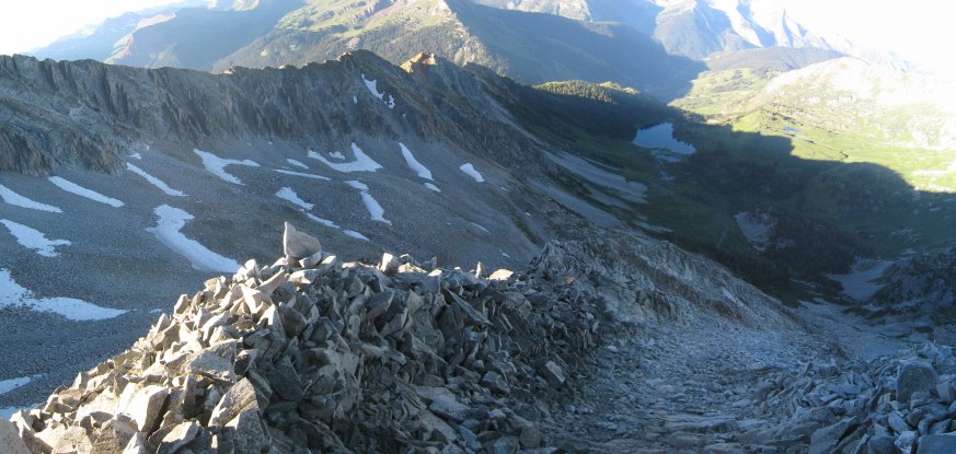
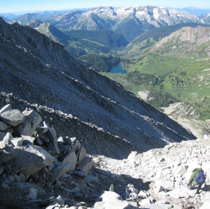
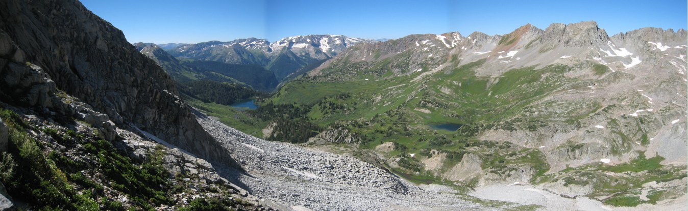
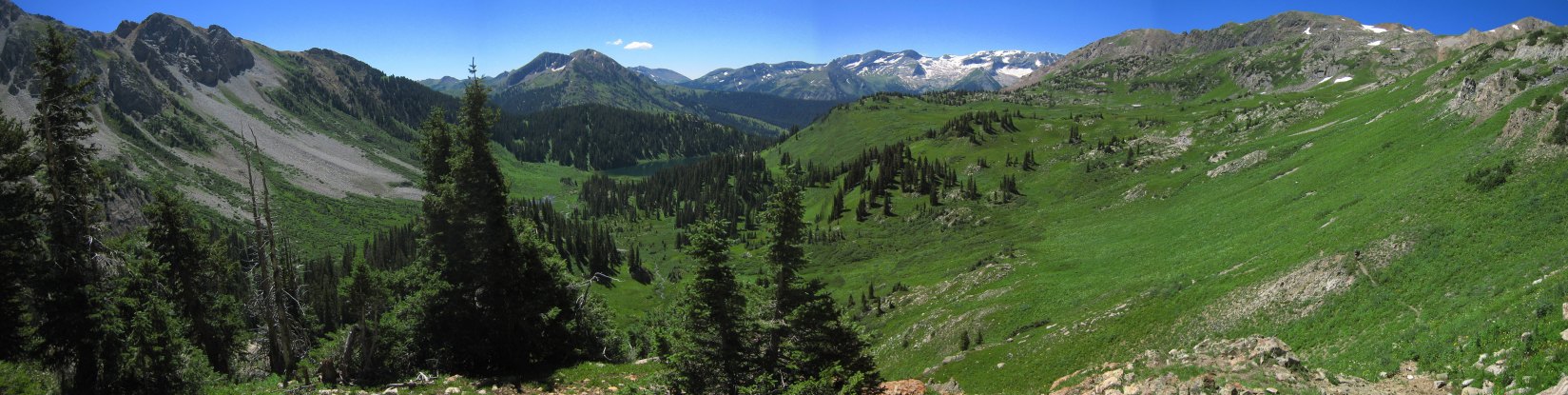
A wide view of the ridge and Lead King Basin below. Gem Lake is the small lake on the right...
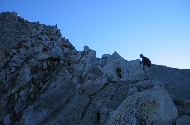
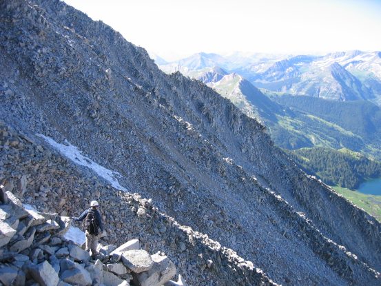
A ways up, Carl rejoined the ridge. The buttress bypass stays off the ridge for quite awhile and climbs back up along loose dirt/rock. The peak was well within grasp now...

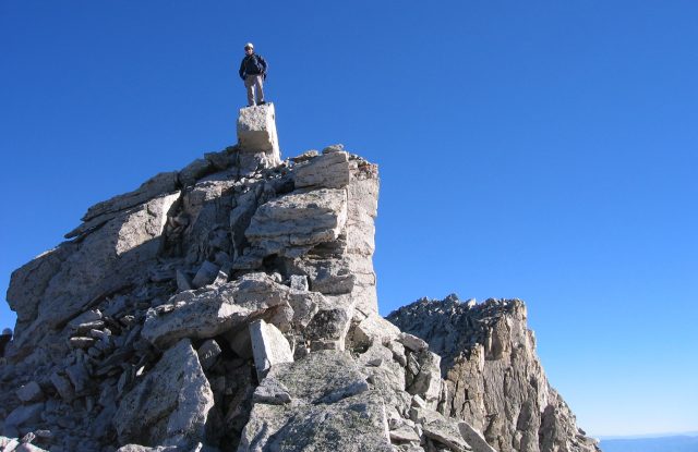
We reached the summit at 8:30am. Tom looks over the tall rock on Snowmass's peak, with Capitol Peak in the background...

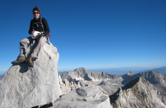
A close-up view of the switch-backs for the road we arrived on yesterday. We camped in this area. Carl takes a photo of me on the summit block...
Once again Capitol Peak on the left. Given the tremendous weather, we decided we had time to scramble over to North Snowmass, the peak in the foreground on the right...
There wasn't much of a trail leading to N. Snowmass, so we followed the ridge north, staying to the left of the spiky ridge at times.
This ridge scramble was fun, as I hadn't explored it before. The ridge was rough, but not too exposed. I climbed up to a high point on the ridge, and found we had to bypass some of the ridge on the left. We needed to descend down to the saddle between Snowmass and N. Snowmass, but there wasn't an obvious path on the ridge, so I took a steep dirt trail descending to the east...
The descent was steep though not very exposed, and I soon saw the open saddle to the north. Carl and Tom stayed on the ridge and popped out in the saddle, as I cut over to them...
From the saddle, it was a simple scramble across the left side of the ridge up to North Snowmass. Notice Carl in the red jacket near the cut in the ridge...
We reached the scenic summit of North Snowmass at 9:10am. The views were even more amazing, as we had a direct look at Capitol, and views of Snowmass...
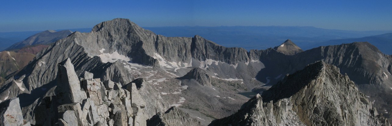
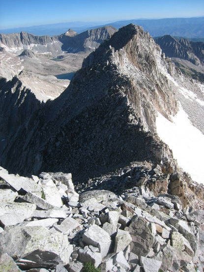
A look back at Snowmass, with the Maroon Bells on the left. North Snowmass is a 14,000' peak, but doesn't count as a 14er, cause it has less than a 300' rise from the saddle between Snowmass...
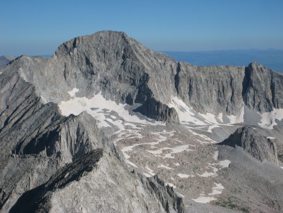

A look at Capitol and the insanely long and sheer ridge from Snowmass to Capitol. This looks way harder than the Little Bear - Blanca Traverse, and I've read it's a 5.8 climb. Still, some brave people have done it. The initial descent would be extremely steep, so you probably have to skirt down to the left and cut over lower down...
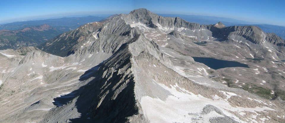
A wide look towards Capitol from North Snowmass...
After 10 minutes on the windy and chilly summit, we hiked back to the saddle, and looked to descend via the west face of Snowmass...
The rock slope leading down from North Snowmass emptied out into the valley much further north than what I remembered from the descent two years ago, so I led us south across the rock face as we looked to find the standard West Face route from Snowmass. There were weak signs of a trail during this traverse...
A look back at Tom and Carl as we cut across the rock face. Once we cleared the next rib in the rock ahead, we'd be on the correct descent path...
A sweet look at the Snowmass - Capitol ridge leading down from North Snowmass, as Tom and Carl near the West Face of Snowmass...
After crossing the next rib in the mountain, the west face opened up, leading down "nicely" to Gem Lake. "Nicely", if you don't mind 2400' of loose rock. Carl's pic of me on the right. Tom and Carl scrambled down the left side of the broad gully, while I choose the right side (having descended the left side last time)...
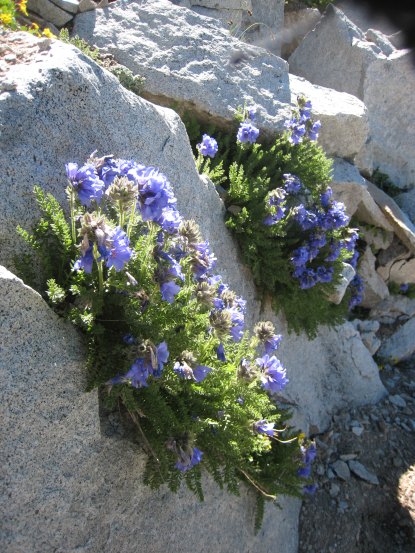
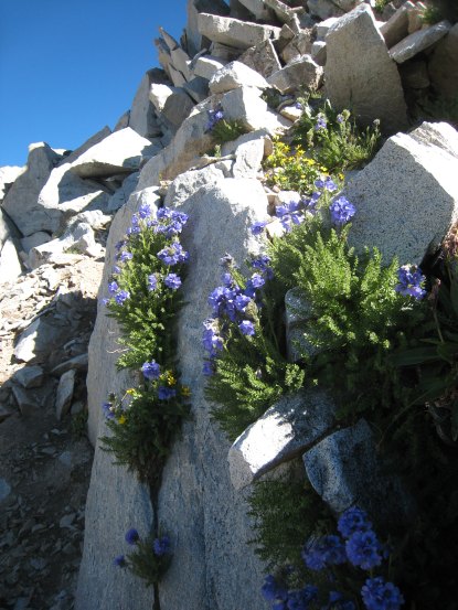
Half way down the rock face, I found some pretty purple flowers...
We were all well separated, and would hear the occasional clanking of rocks echoing across the broad gulley, when one of us would dislodge some loose rocks...
There were more flowers and greenery as we passed a small waterfall ~3/4ths of the way down. Carl descends in the background of the right pic...
A look back up Snowmass, from the final rocky section. I'd say it's best to keep to the left on the way down, until the waterfalls, as the rocks are larger. The left side has a bit of a dirt trail, but it's slippery...
A look south, just before the end of the descent into the upper basin. The stream crossing is below...
Tom was a speedster down the rock slope, and was waiting for us at the bottom. It took us ~1.5hrs to descend the ~2400' from North Snowmass. The rest of the way would be a gentle dirt trail...

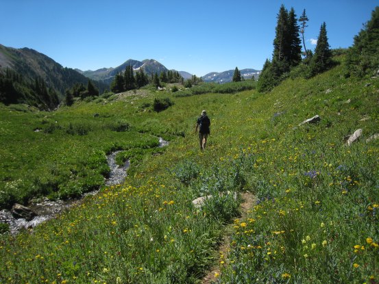
After a decent rest, we made our way up towards Gem Lake, passing a snow patch along the way...

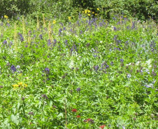
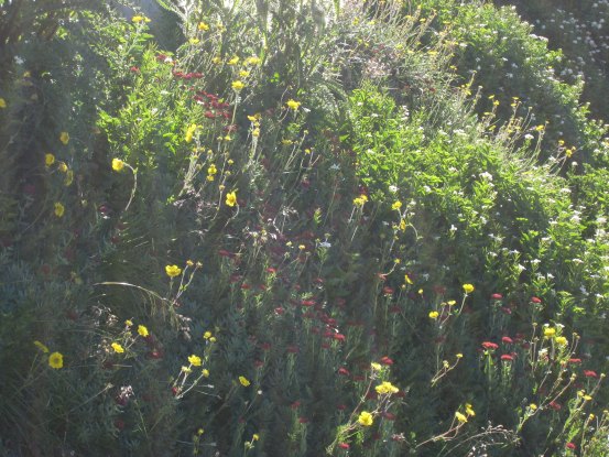
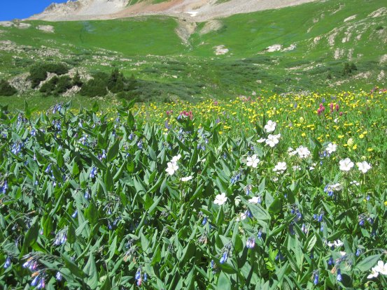
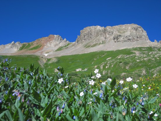
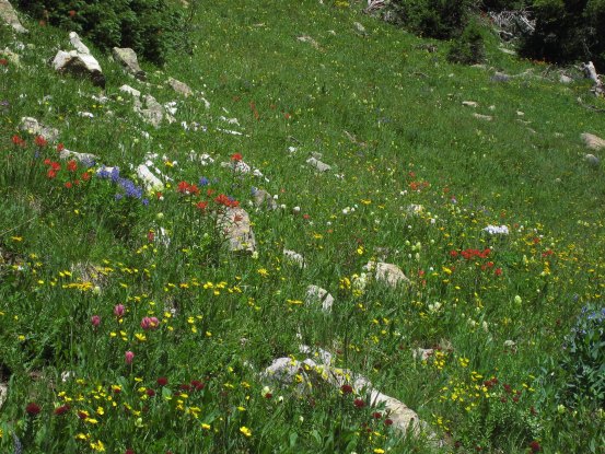
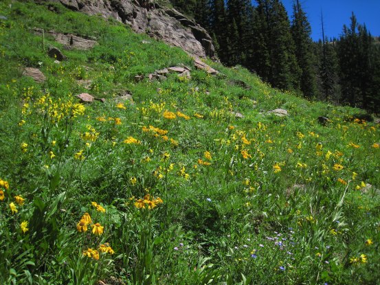
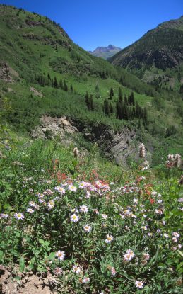
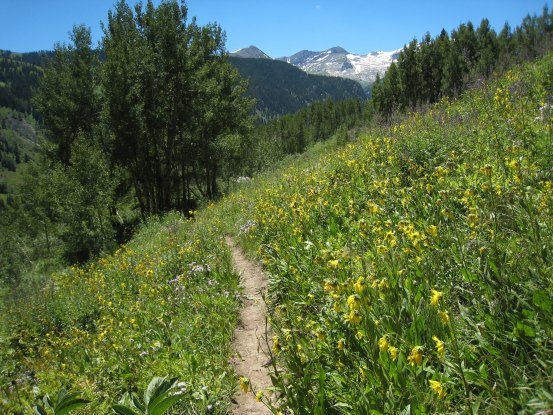
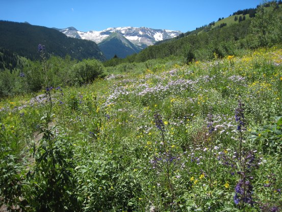
We quickly were overloaded with gorgeous wildflowers on both sides of the trail...
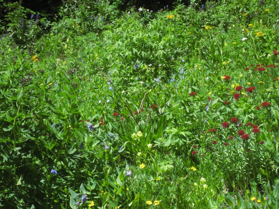
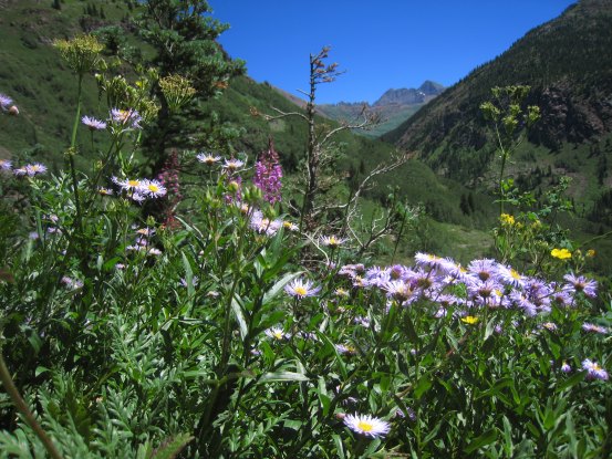
What was most impressive was the large variety of color...
The peak variety of color came just before reaching Gem Lake...
Some closer looks at the flowers here...
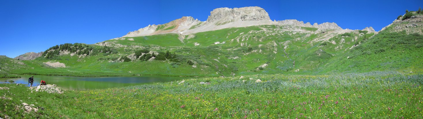
Tom and Carl take a break at the lake. This was definitely the place to hang out for awhile, and enjoy the flowers and wonderful blue skies...
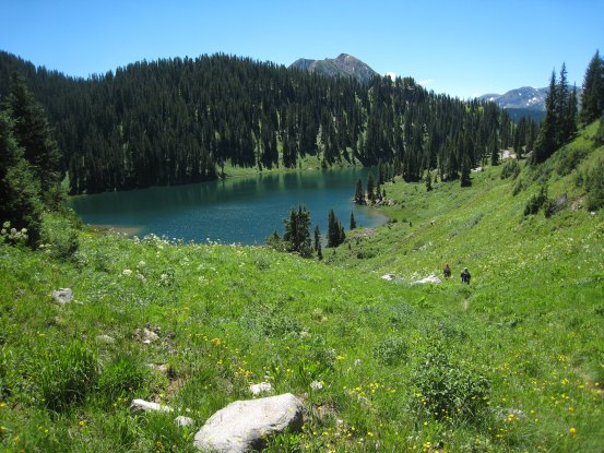
A look at Gem Lake, with Snowmass on the right...
The scenery from here was gorgeous in all directions. I went back to join Tom and Carl, who were eating some freeze-dried ice cream that Tom brought. We agreed it tasted better than the freeze-dried ice cream sandwich from last week...
Tom walks past the edge of Gem Lake, with Snowmass behind. In the other direction, Carl follows the trail through the flowers, along a stream running from Gem Lake...
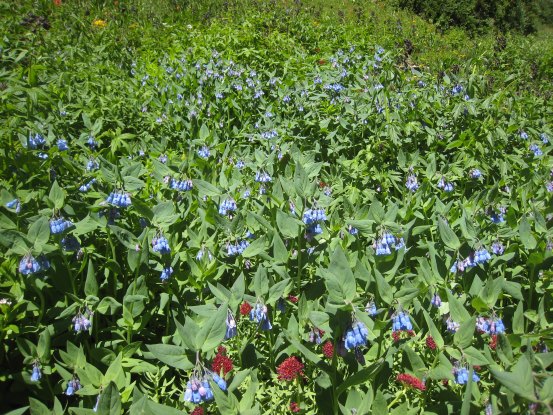
The lush greenery along the trail was splendid. Soon we saw Geneva Lake in the valley below...

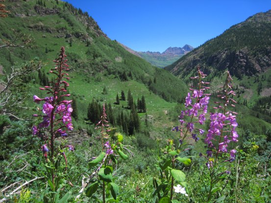
More pics of the colorful flowers along the trail...
Tom thought this scene reminded him of Switzerland (but without the cows). Carl is ahead on the trail, on the right...
Carl took a pic of Tom and I at the lookout from the above pic. Tom and Carl got further ahead in the flower soaked field, as I stopped more and more to take pics.
Another pic of the flowers along the trail...
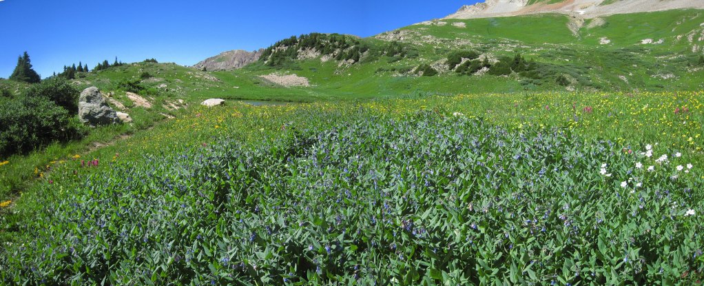
A meadow full of flowers below Snowmass...
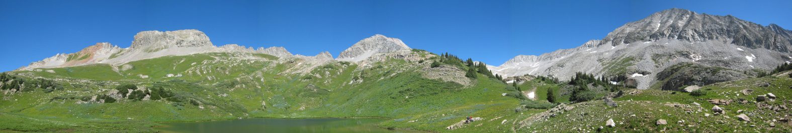
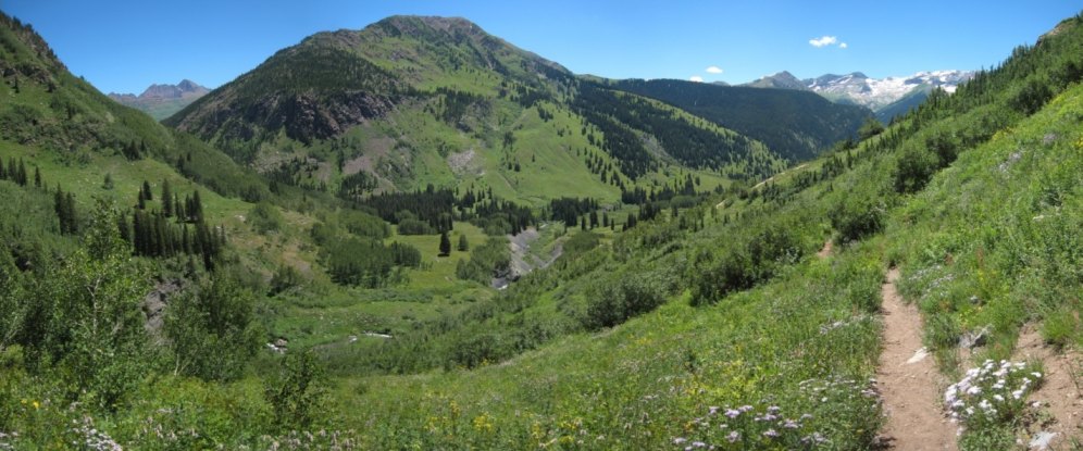
This area is surely one of the most beautiful in CO. The trail winds across the green slope and above the ledge towards Gem Lake...

A look at a tumbling stream on it's way to Geneva Lake, lined with wild flowers. Geneva Lake is quite green. We saw the first people of the day as we reached Geneva Lake...
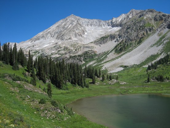
A look back across Geneva Lake, at Snowmass...
The trail winds down below Geneva Lake...
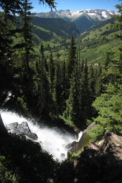
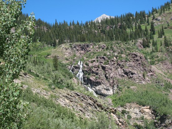
I saw a side trail, and guessed it might lead to the top of the waterfall. Tom and I took it, and sure enough, the ~200' long trail led us to a large waterfall...
Back on the main trail, the wildflowers didn't let up. Further on we got a view of the waterfall we had just visited from above...
More pics from the scenic trail. The waterfall can be seen in the right pic...
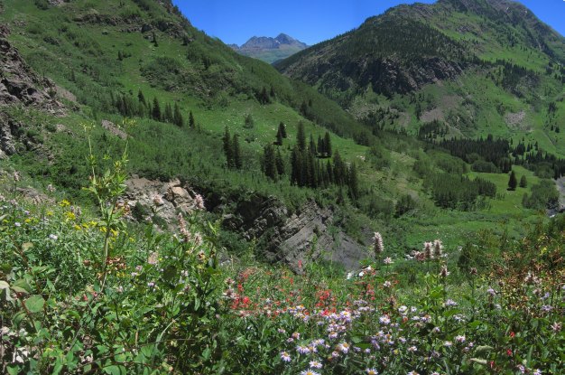
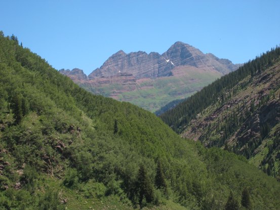
Soon we reached a spot where the Maroon Bells pop into view in an opening between the mountains. The entire traverse from South to North Maroon was visible...
I spent a long time in this area, taking pics of the flowers and the Bells...
The hike back was almost finished, but there was still plenty of beauty left to behold...
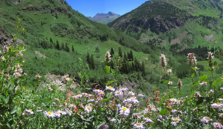
A few more pics of flowers and the Bells, before the Bells disappeared from view...
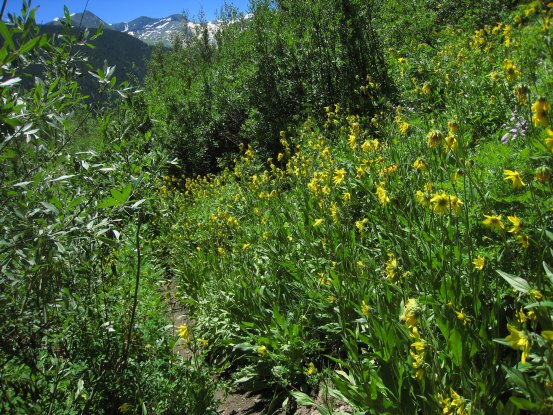
More magnificent yellow flowers dressed the meadows and hillsides as we descended. Another waterfall appeared further down too, as Snowmass disappeared from above...
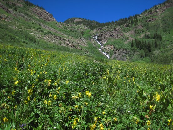
The yellow flowers certainly ruled down in the valley...
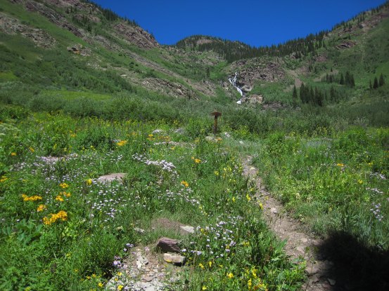
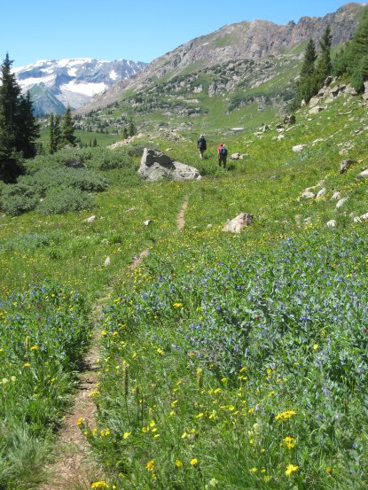
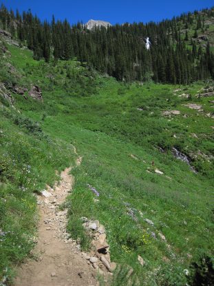
A look back at the first fork in the trail. When hiking towards the S-Ridge/West Face of Snowmass, just keep taking the path to the left, and you'll arrive at Gem Lake. A last look at the wild flowers before arriving back at camp...
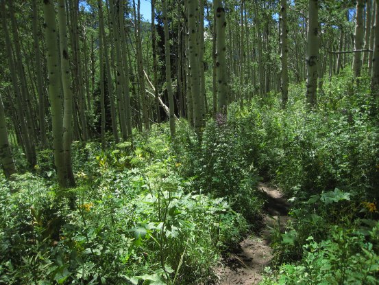
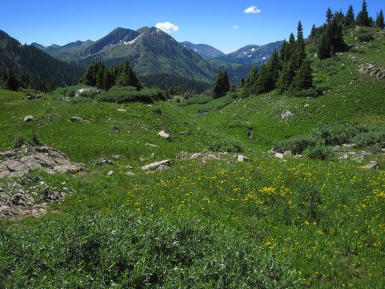
After a quick jog through an aspen grove, I arrived back at camp ~1pm (~8hr 45min round trip hike today), where Tom and Carl were already packing up. I joined in, and we were ready to hit the 4x4 road ~1:30pm...
A look towards Snowmass as we drive the switchbacks up and out of Lead King Basin...
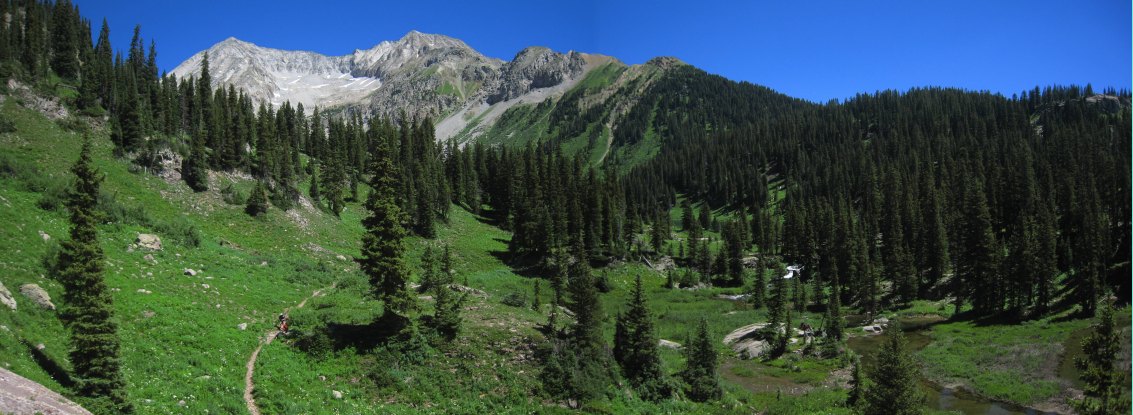
A close-up of the S-Ridge (on the left). There were plenty of wildflowers along the road here too, though they disappeared by the time we reached Marble...
It took us 70 minutes to make it back to Marble, over the 4x4 road. We couldn't call the trip a success until we hit the paved road, given we had no spare tire, and could then rest easy. The drive back was smooth, with a stop at Subway in Glenwood Springs. We got back to Ft Collins ~8pm.
Snowmass was my first repeat 14er, and it might be my top choice to repeat again. Last time I left this gorgeous area, I wondered if I'd ever be back again. This time I consider it likely that I'll return...